
Welcome to the web pages of the
Whareroa Guardians
Community Trust

Map of Whareroa
For a closer look, click on the map. For details of the tracks, click here
How to get to Whareroa, click here
Opening hours: Summer (daylight saving time): 8:00 am - 9:00 pm Winter: 8:00 am - 6:00 pm
You can find the Toyota Kiwi Guardians map here
A Whareroa special map: handcrafted by Ann in December 2024, showing all the latest amendments.
You can find an easy overview of location names of Whareroa Farm here
The DOC website coverage of Whareroa Farm is here. See also coverage of Whareroa Farm on the Wellington Regional Trails website

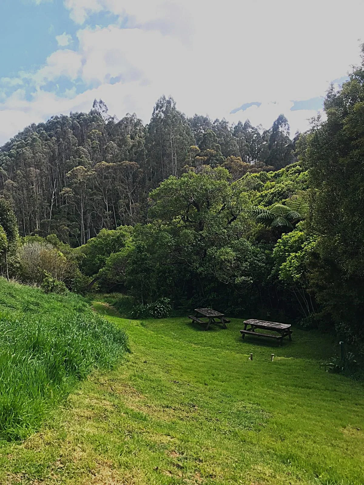
Picnic tables
There are plenty of picnic tables scattered through Whareroa; near the entrance, at the Hub, two in the Dell, near Matai Bush, along the Race, a few minutes into the Ramaroa track, near the Marines Water Intake/Silt Trap, up at Five-Ways near Campbells Mill Road and a few others around the place
The Cairn
The Cairn Lookout is one of the “Whareroa Special Places” (other “Special Place” locations are identified by red stars in white circles on the map here)
Using 7 marker stones transported from Taranaki and the rest collected by volunteers from around the Whareroa Farm in 2013 and early 2014, the Cairn is a reminder and commemoration of the vision, hard work and persistence of those who fought to preserve Whareroa in public ownership.
After completion, it was blessed by Kamatua Don te Maipi at a celebration in February 2014 (thanks to Jan Nisbet for the photo)
You can find out more of the background to the Cairn in this article from the Kapiti Observer, June 20, 2013, the Kapiti Independent News, February 25, 2014 and read the history of Whareroa Farm here
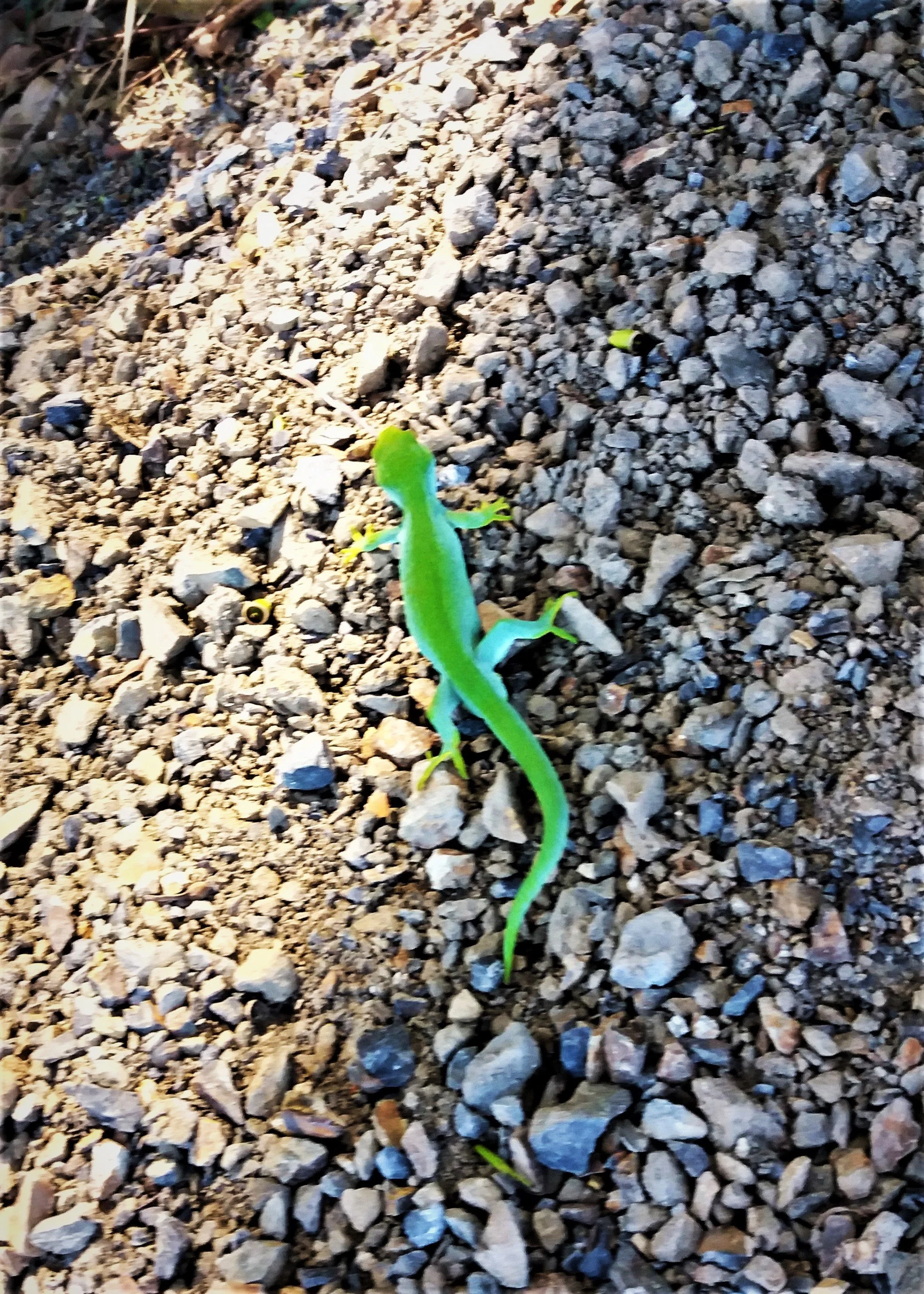
On January 21, 2025, after much long organisation and preparation, 11 northern grass skinks were translocated from Ngā Manu Nature Reserve to their new home in The Cairn. Click here for the original posting and photos of the translocation day
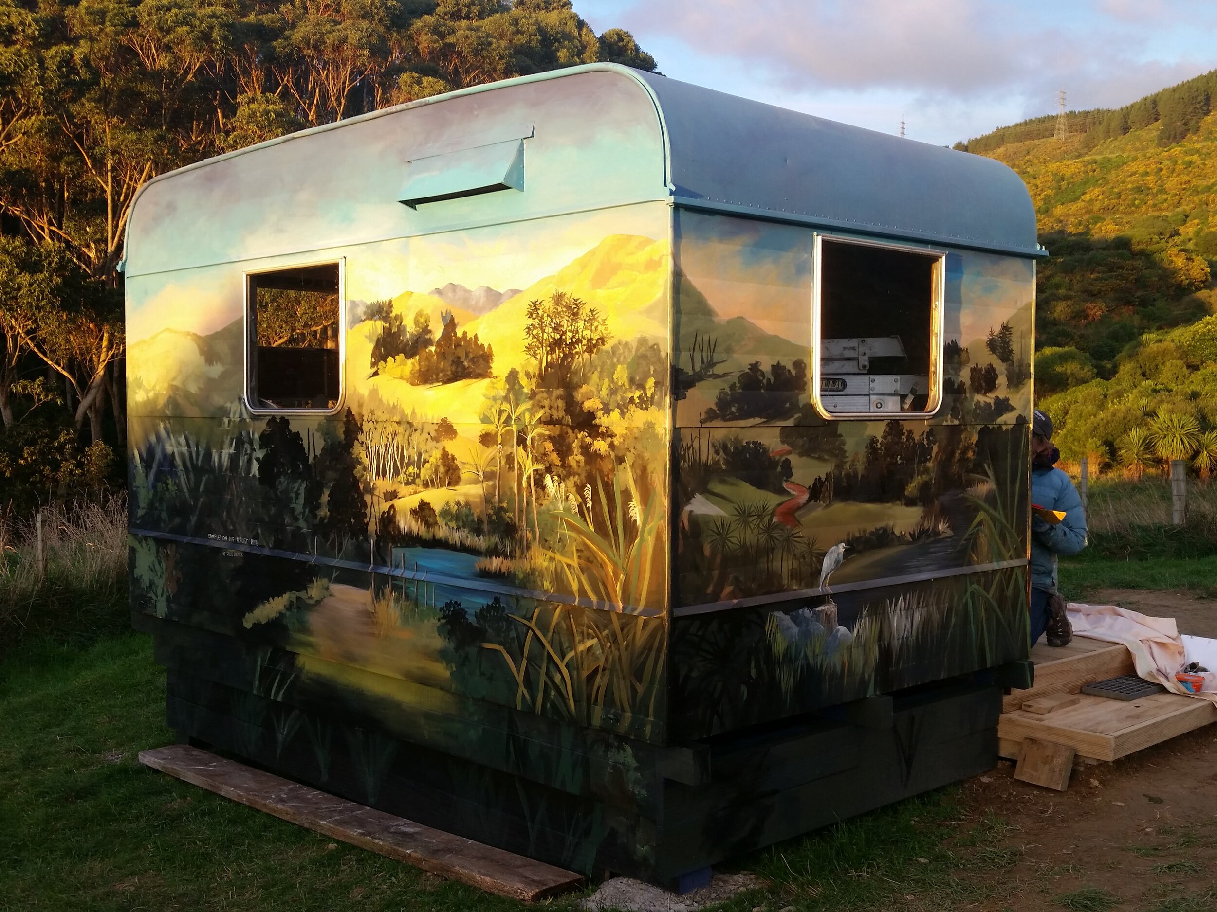
Caravan Mural At The Hub
The Caravan Mural is one of the “Whareroa Special Places” (identified by the red stars in white circles on the map here)
You can read the story of the caravan from this DOC Conservation Blog Post from June 5, 2018, and this report in the NZ Herald by Rosalie Willis (which includes a short video) from May 22, 2018, shortly after Julie had commenced painting the mural.
A chronological compliation of working bee and opening ceremony reports from the Supporters’ Updates and other places are in this document
To get the caravan to where it is today (the Hub) we owe many thanks to: Kapiti Menzshed for restoration work, Dulux for donating paint, Wellington Community Trust for grant for artist and display cabinets, DOC for grant towards foundations and deck and picnic table, DOC staff for help with history and general support, Whareroa Guardians’ volunteers who built foundations, deck and seat and helped with mural and, especially, Julie Oliver, artist with partner Tim Gilbertson
Urban Hut
The Urban Hut is one of the “Whareroa Special Places” (identified by the red stars in white circles on the map here)
Created as part of the NZ Festival of Arts, completed in January 2020, the Urban Hut in Whareroa is one of 5 urban huts hand constructed by Artists Kemi Whitwell and Niko Leyde, or the Urban Hut Club (Kemi Niko & Co)
You can find a map to all 5 huts here
The Urban Hut Club has an instagram account here with a great Instagram story recording the development of the Whareroa Urban Hut here (you will need an Instagram account to view postings on Instagram)
And here is an article which were published as the Urban Huts were in the process of conception and construction in Good magazine
Thanks to Peter O for the photo

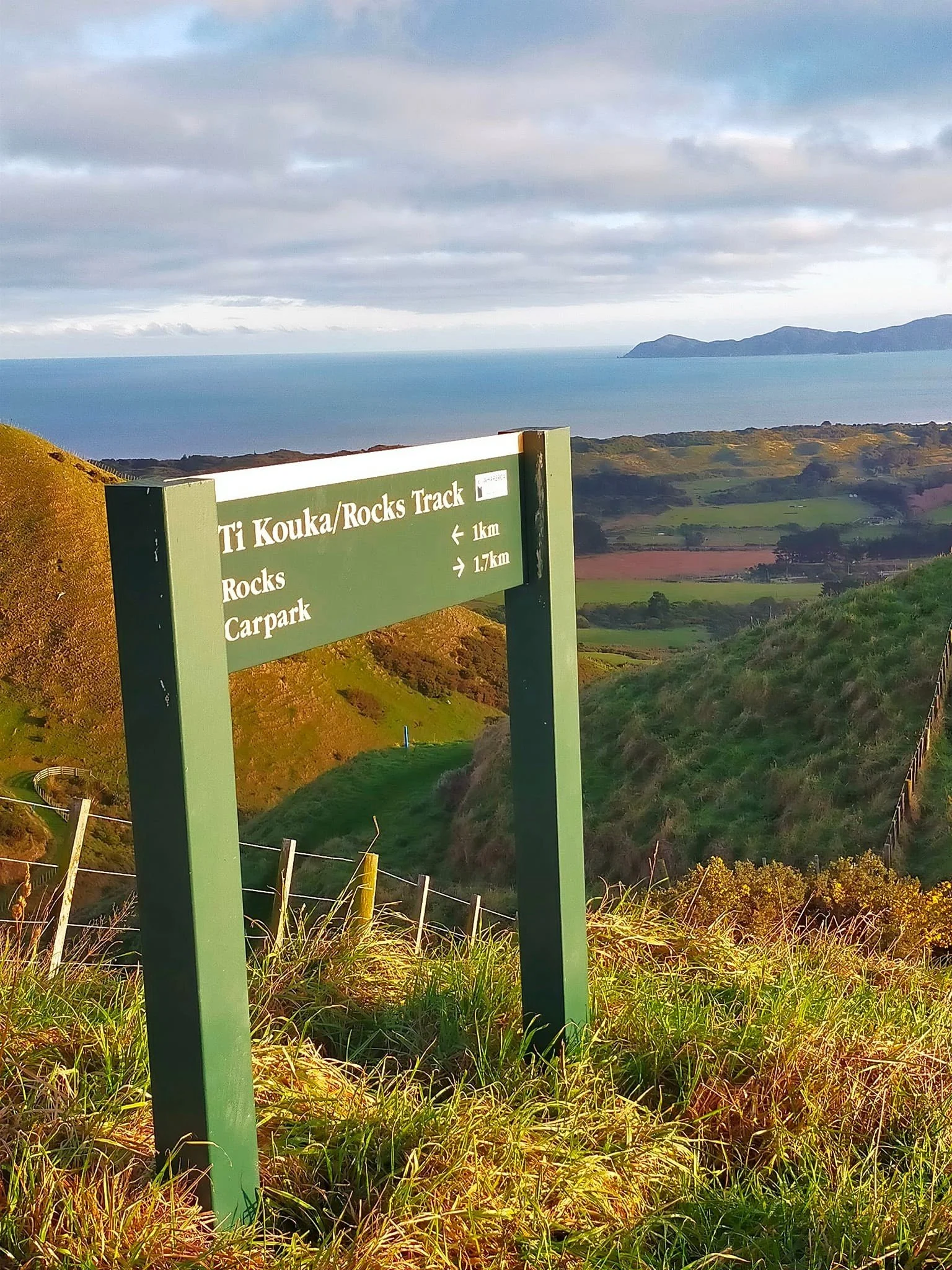
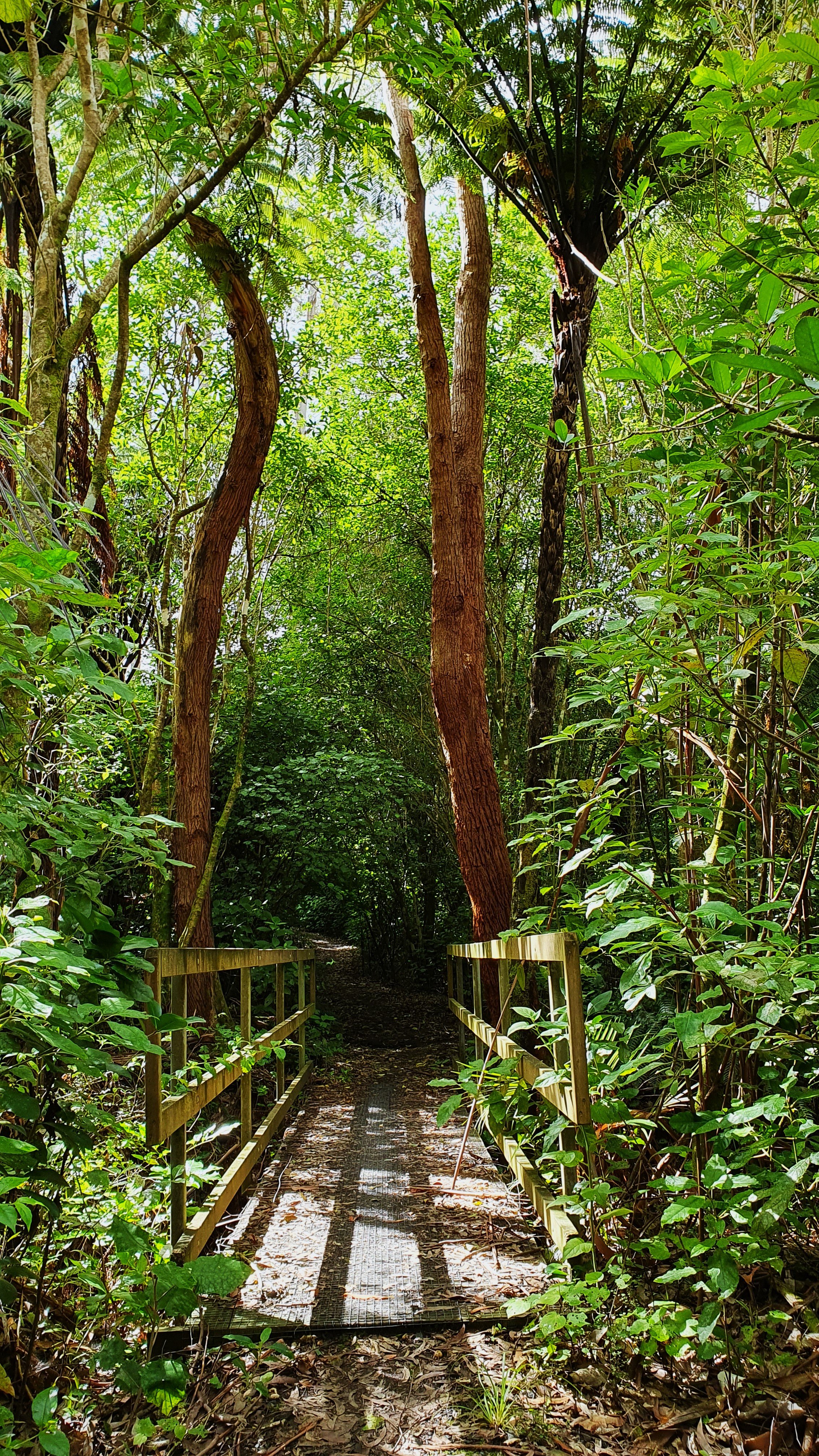
Ramaroa Bush
You can experience one of “Whareroa’s Special Places” (identified by the red stars in white circles on the map here) by following the Te Ara Ramaroa track.
It meanders along the western edge of Whareroa Farm, through the Ramaroa Wetlands into the Ramaroa Bush, then turns east along the southern edge of Whareroa Farm ultimately heading up into the hills to the Rocks Lookout to the south east.
Here are just a few of the photos of the working bees and the opening ceremony of the Te Ara Ramaroa Track in 2016
Wellington Botancial Society visited in 2021 (reported here)

The Marines Heritage Walk
A 50 minute walk with story-boards (maps, pictures and information) at 7 sites. Well worth a look at how the Marines were using Whareroa Farm 1942 – 1943. You can find more information here.
The Dell
The Dell is one of “Whareroa’s Special Places” identified by the red stars in white circles on the map here
Defined as “a small secluded wooded valley”, the Whareroa Dell has been crafted in a series of Working Bees into a lovely area sometimes used for music or for just taking a break.
Not far from the Hub where the Caravan is located, the most direct path to the Dell will mean crossing a small stream and maybe getting your feet wet.

Toyota Kiwi Guardians at Whareroa Farm
Sadly, this programme was stopped in August 2023 due to lack of DoC funding.
However, the Whareroa Farm challenge remains in place, click on the map here to enlarge it, follow the instructions and collect the letters to find out the code word.
You can win a great sense of achievement but sadly no longer a certificate nor a medal for sending in the code word.

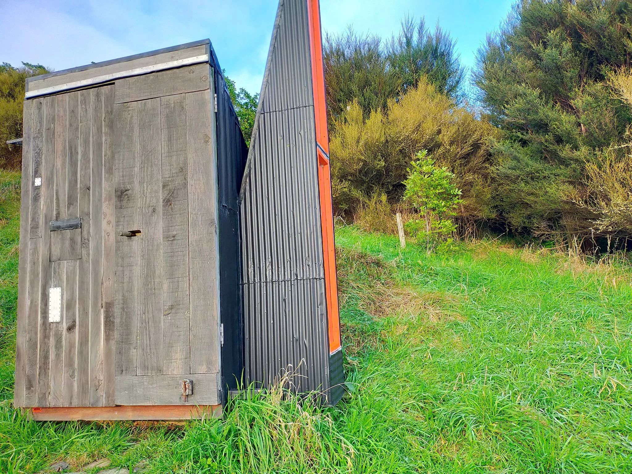
Old Tararua Dunny
Rescued, restored and relocated.
If you are near the Hub and wondering what the story is behind that perhaps unexpected structure, you can read all about it here

Geocaching
There are a number of geocaches hidden throughout the Whareroa Farm Reserve by private individuals.
You can set-up a free Geocache account (then you can see a map of all the geocaches in the world, log your finds and much more) here
For those of you new to Geocaching, a guide and a lexicon
Good hunting! p.s. take a pencil or pen with you to record your find on a register located in each Cache ;-)

Horse Riding
Equestrian access through Whareroa Farm and along Campbell’s Mill Road is controlled by locked gates. See the map above for tracks for horse riding or click here. To rent a key contact Kāpiti Coast District Council Phone: +64 4 296 4700. Leave gates as you find them.
Mountain Biking
Check out the map of Whareroa Farm Reserve for bike tracks as well as the Department of Conservation and Kapiti Mountain Bike Club.

Know before you go
Water provided is not fit for drinking – bring your own drinking water
Off-road vehicles and motorbikes are not permitted
There is no public access to the grazed areas except on marked walking tracks
Dogs are not permitted
Fires are not permitted
Parking is available at the entrance to Whareroa Farm. Don’t leave valuable items on display in your car when parked.
Walkers must be aware of bikes and horses sharing the trails. Note that two Mountain Bike trails are for bikes only.
Opening hours: Summer (daylight saving time): 8am - 9pm Winter: 8am - 6pm
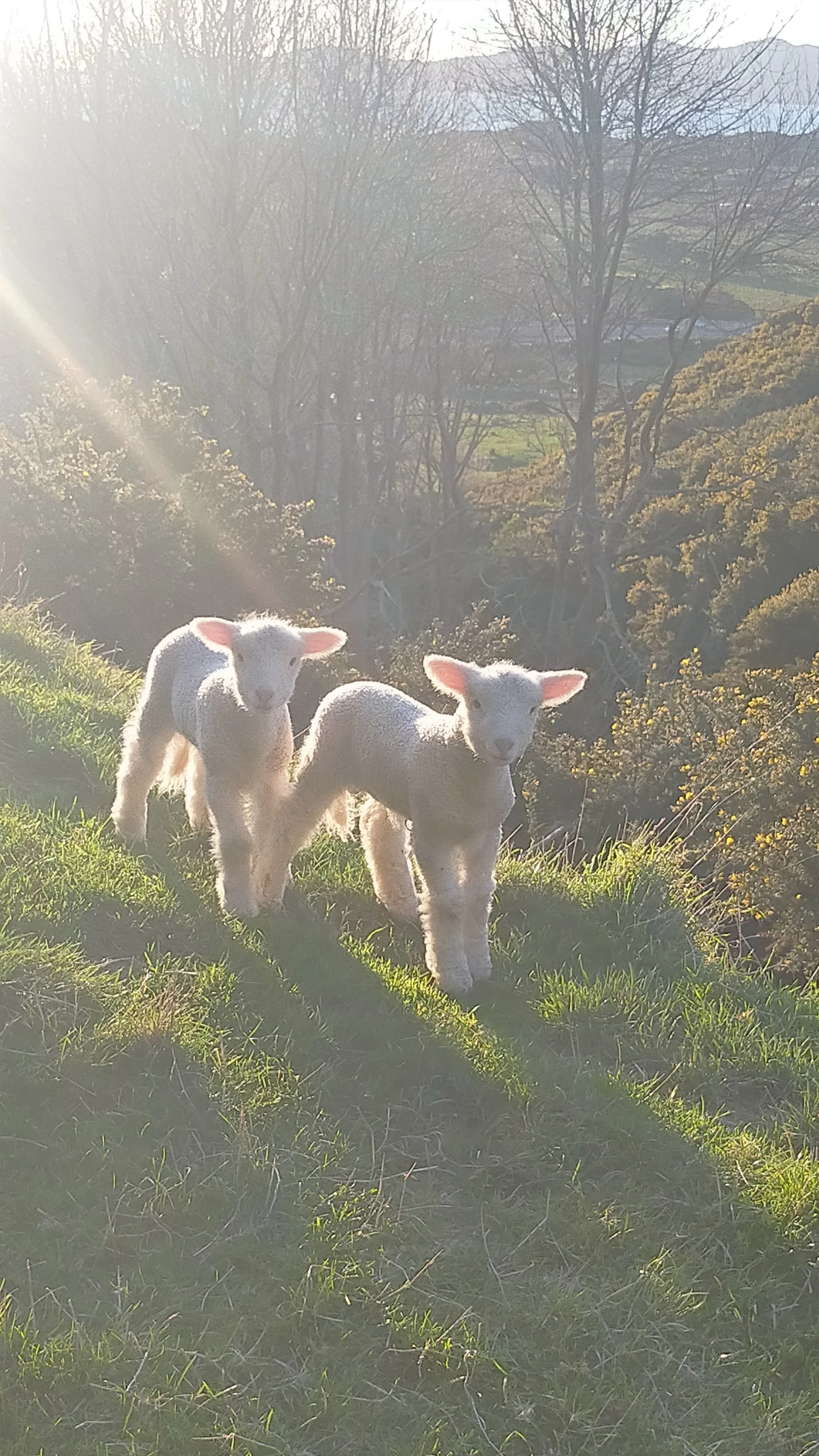
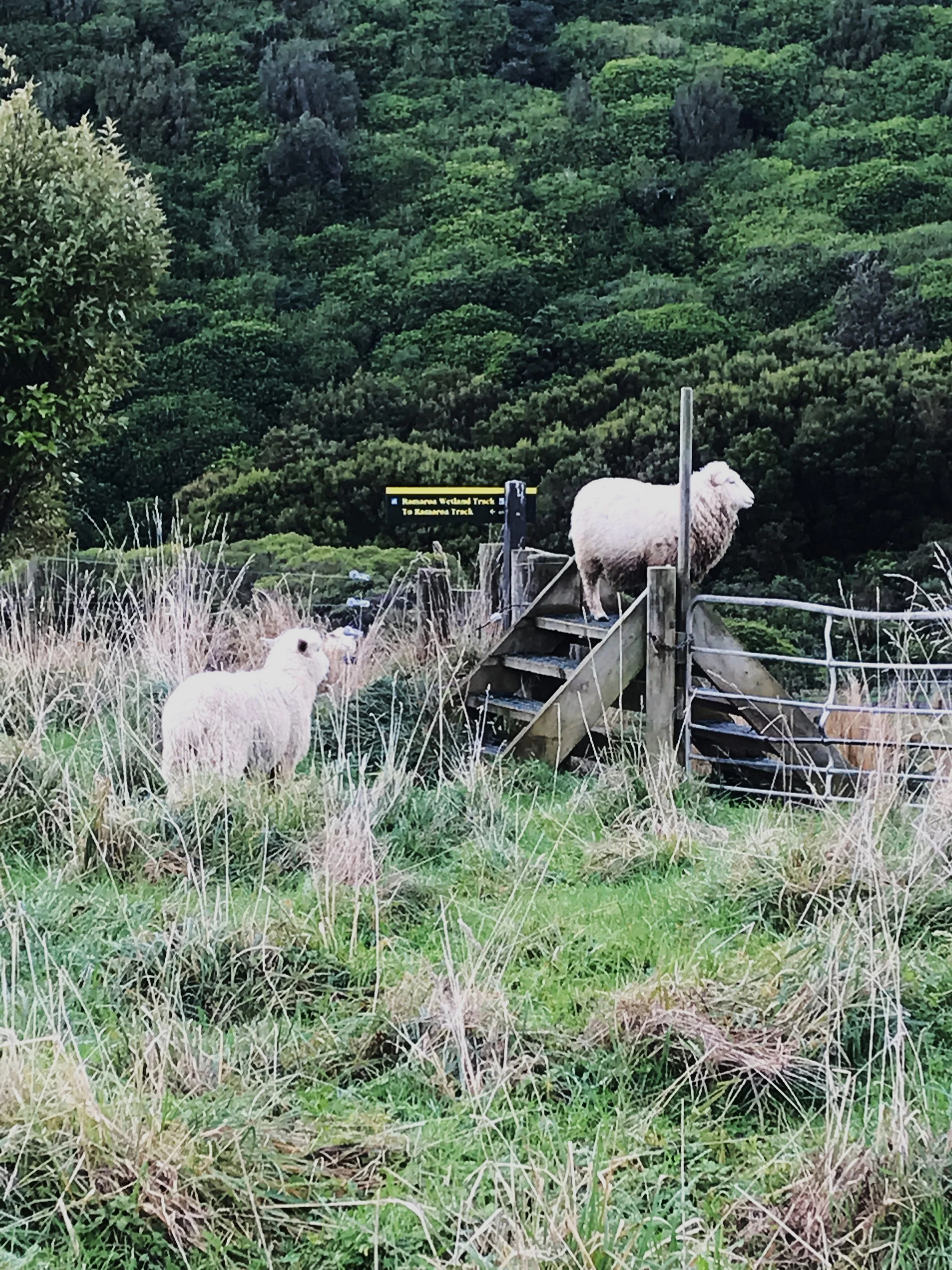
Farmed areas of Whareroa Farm are closed to visitors during lambing and calving from 18 July to 30 September. Keep out of the signposted closed farmland areas, including any tracks across them during this period. Closed areas include the Cairn View Track.
See more on the DOC website coverage of Whareroa Farm here. See also coverage of Whareroa Farm on the Wellington Regional Trails website
Flora & Fauna of Whareroa Farm
On an adhoc basis we will add here items of interest about flora and or fauna sighted on Whareroa Farm
Birds Sighted on Whareroa Farm since 2011: You can find the list, with photos and links to nzbirdsonline.org.nz here
Fish sighted on Whareroa Farm in 2007 and 2022 with photos and links to iNaturalist.org is here
Pest plants sighted on Whareroa Farm: you can find the list, with photos and links to web resources here
Useful links, including websites to identify all different kinds of flora and fauna, can be found here
Jan’s Information Posters: Visitors to Whareroa Farm will find a number of Jan’s Information posters in various places. These were also placed in a website called “naturespace” run by DoC which has long since been closed. You can also find them here:
Butterflies Fungi Wood Ear Fungus Basket Fungus Kahikatea Kawa kawa Kohekohe Manatu Marine Relics (1) Marine Relics (2) Native Fish Nikau Peripatus (velvet worms) Piwakawaka Tunnel Web Spider Te Kouka Turepo (Milk Trees) Weta Motels
Accumulated flora & fauna photos and notes from 2013 to 2016. A a printout of past items collected and posted from 2013 to 2016 and you can find it here
Click here for an impressive survey from 2015 of most plants (vascula plants) and a list of weeds and planted exotic species undertaken by Pat Enright and Chris Hopkins in 10 areas of bush in Whareroa Farm, full of common and Latin names for all you botanists out there.
How to use iNaturalist.org:
Our friends at Kapiti-Mana Forest & Bird have a useful explanation of how to use the very useful website inaturalist.org (see page 2 of their newsletter here). As a bonus, you get within the newsletter, information about a nice walk in the neighbouring Queen Elizabeth Park and honey dew in beech trees amongst other things.
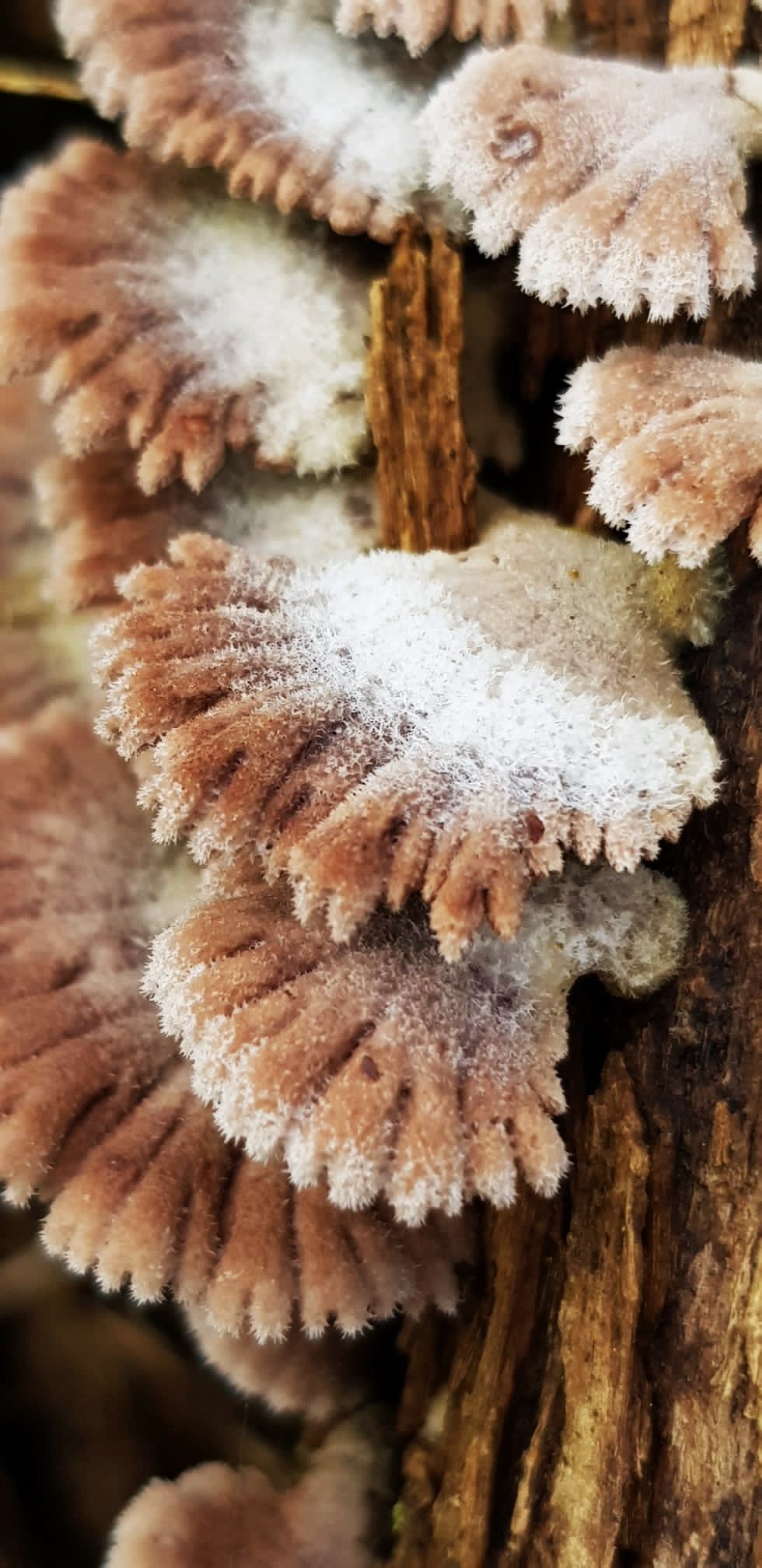
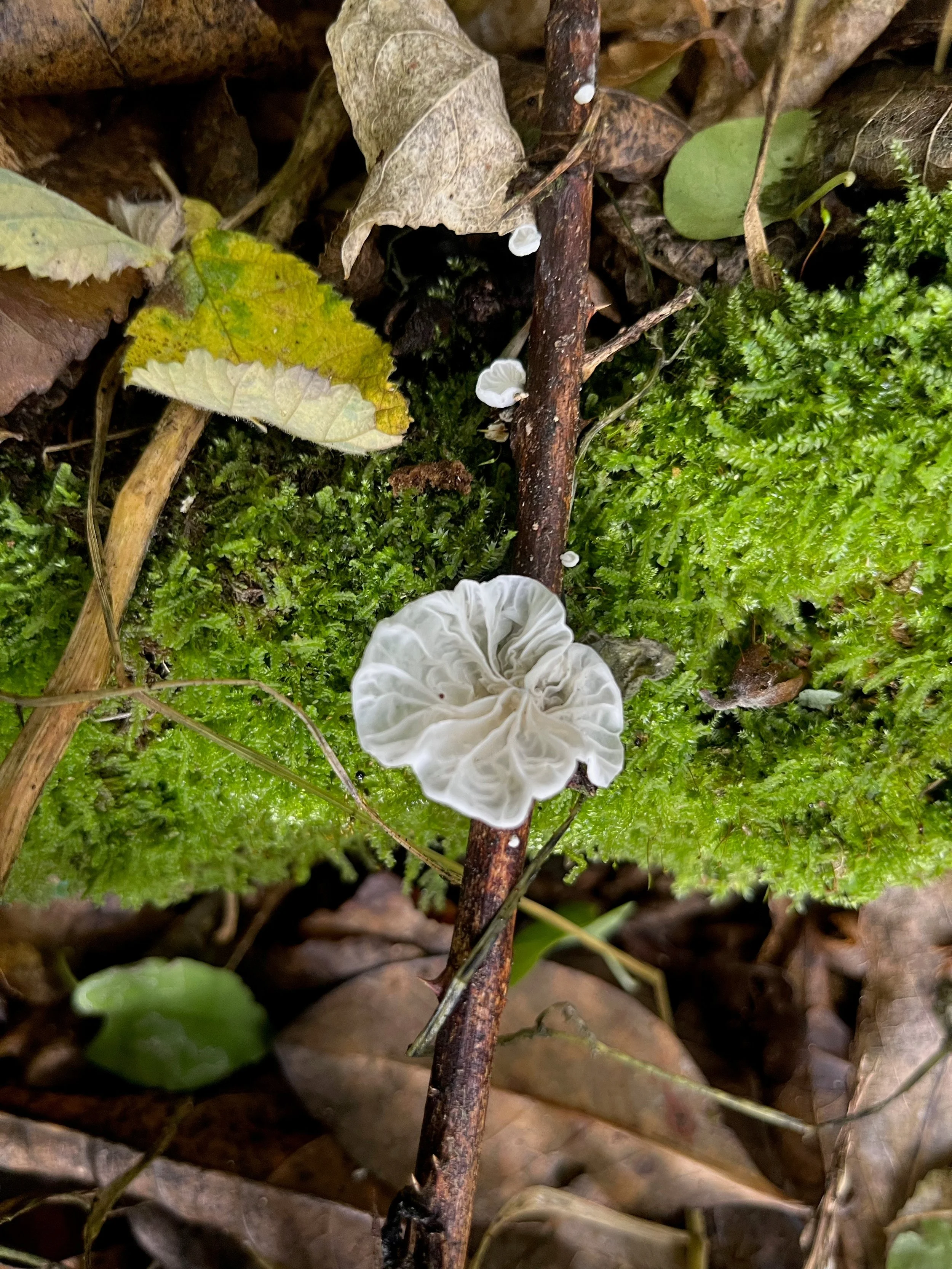
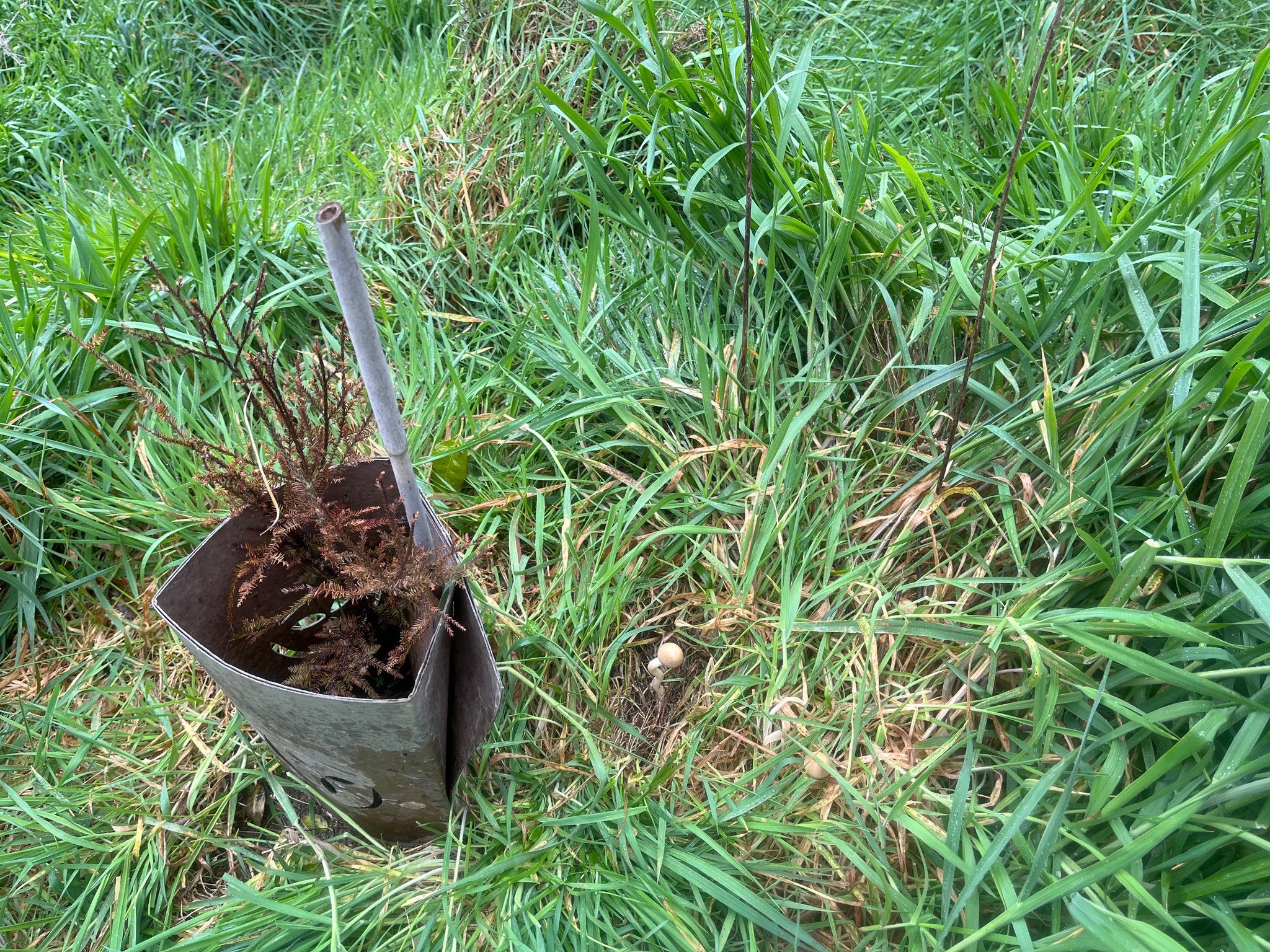
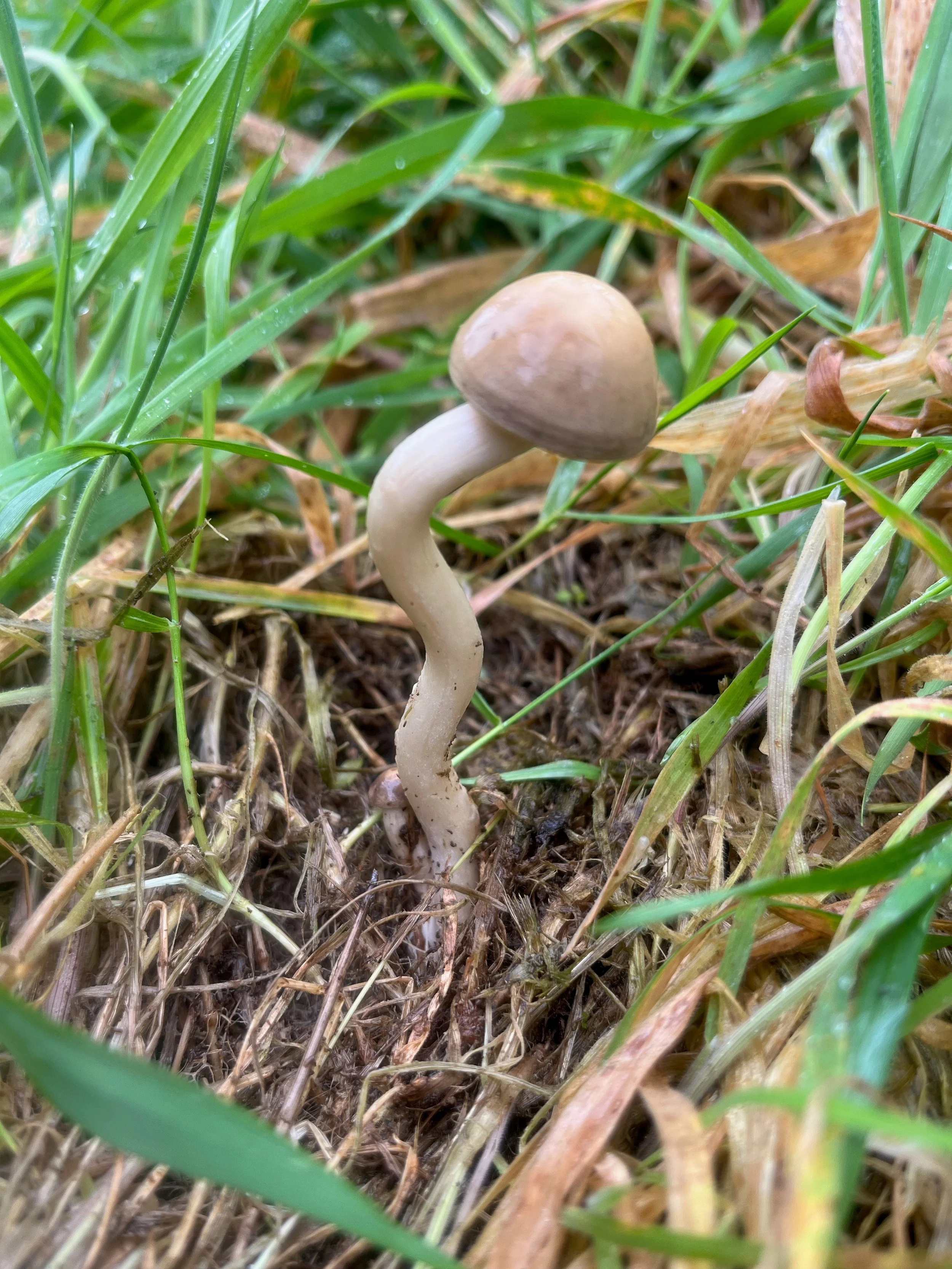
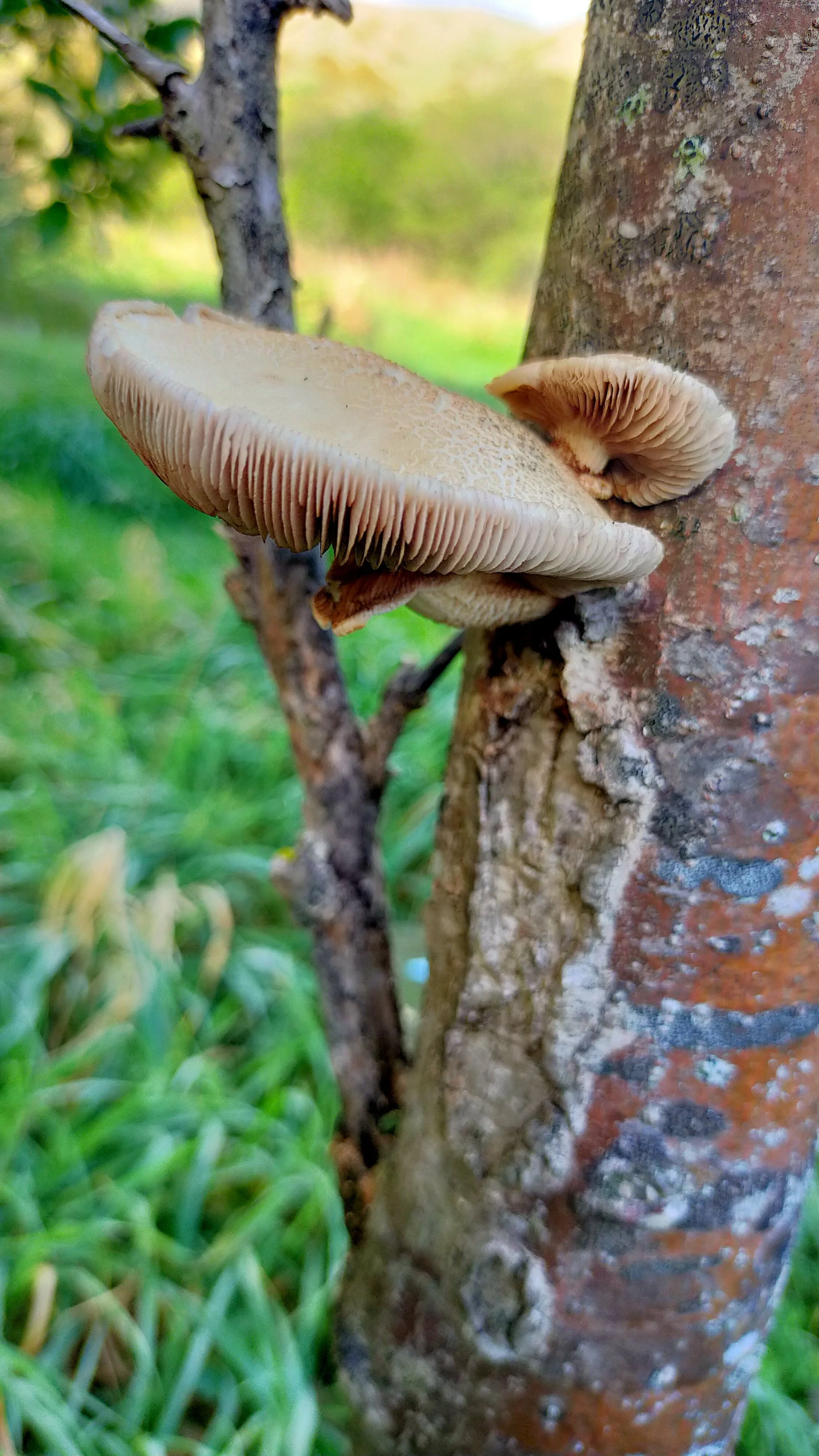
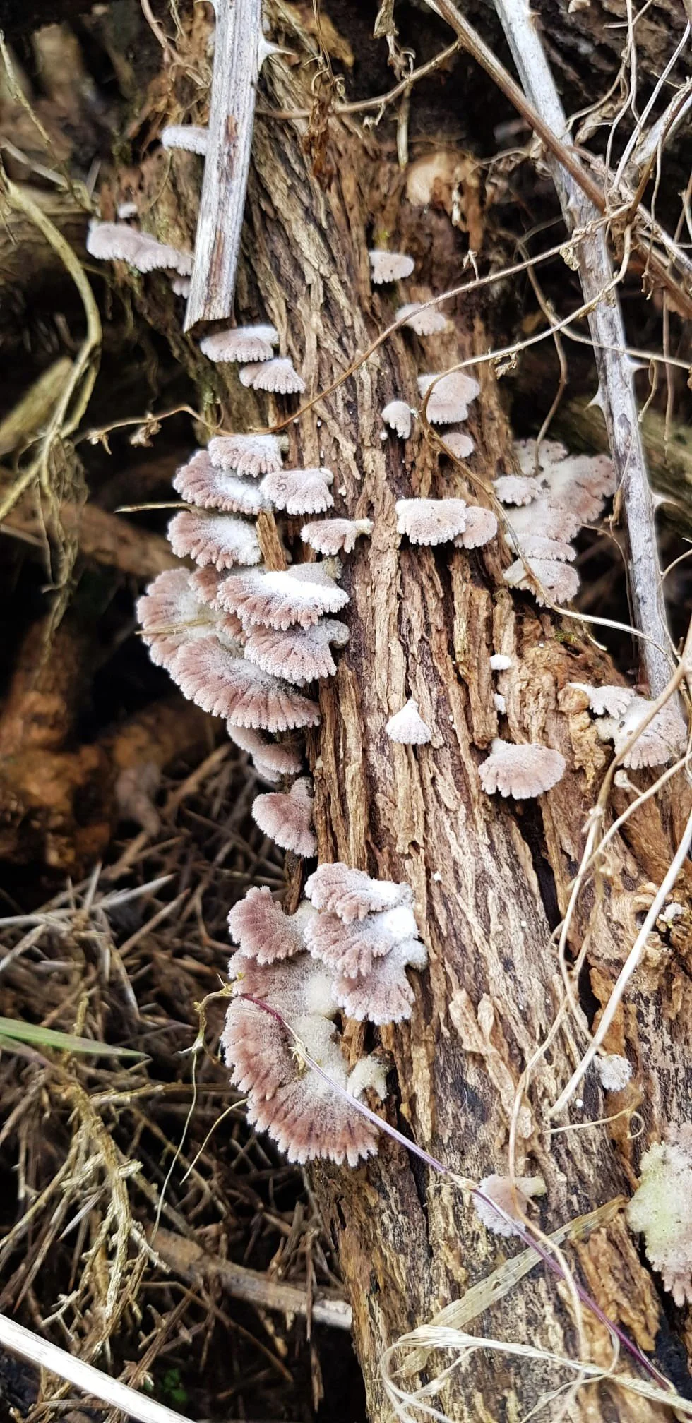
Whareroa Farm Fungi Gallery
-
![]()
Spotted by Blackberry Control Team member Alex, August 2023. Thanks to Andy ID'd as Schizophyllum commune Splitgill mushroom
-
![]()
Found on blackberry in January 2023, photographed by Sue. Thanks to Keri ID'd as Campanella tristis
-
![]()
Where Sue found the fungi determinati
-
![]()
Photographed by Sue in September 2023. Thanks to Susan ID'd as Fungi Determinati
-
![]()
Seen in June 2024 at Whareroa on dying ribbonwood (thanks Jan) and called tawaka (Cyclocybe parasitica)
-
![]()
Where Alex found the Schizophyllum commune splitgill mushroom
Picture Farm Gallery, latest …

Freya was kind enough to leave us a note at the mini-hut. Thank you Freya, we completely agree with you! Click on the photo to find out more about the mini-hut. Photo Jan, 5.6.26
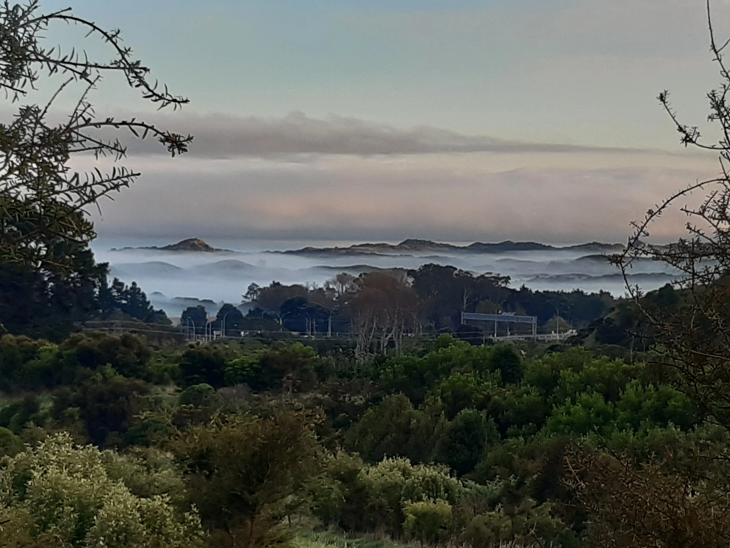
Early morning, from Totora Ridge on Whareroa Farm looking north-west towards the dunes in QEP. Photo Ann, 27.4.26
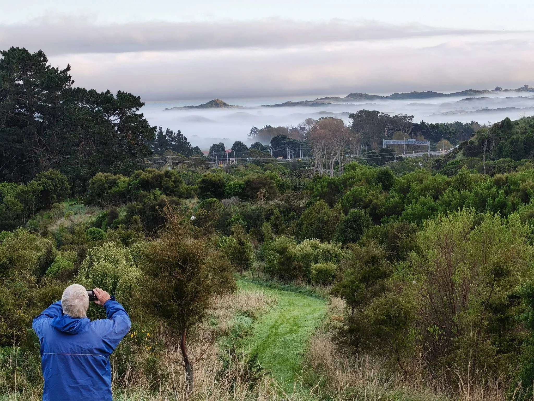
What goes on behind a picture. Photo from Jan.
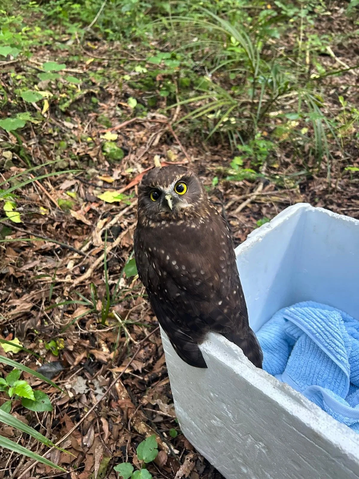
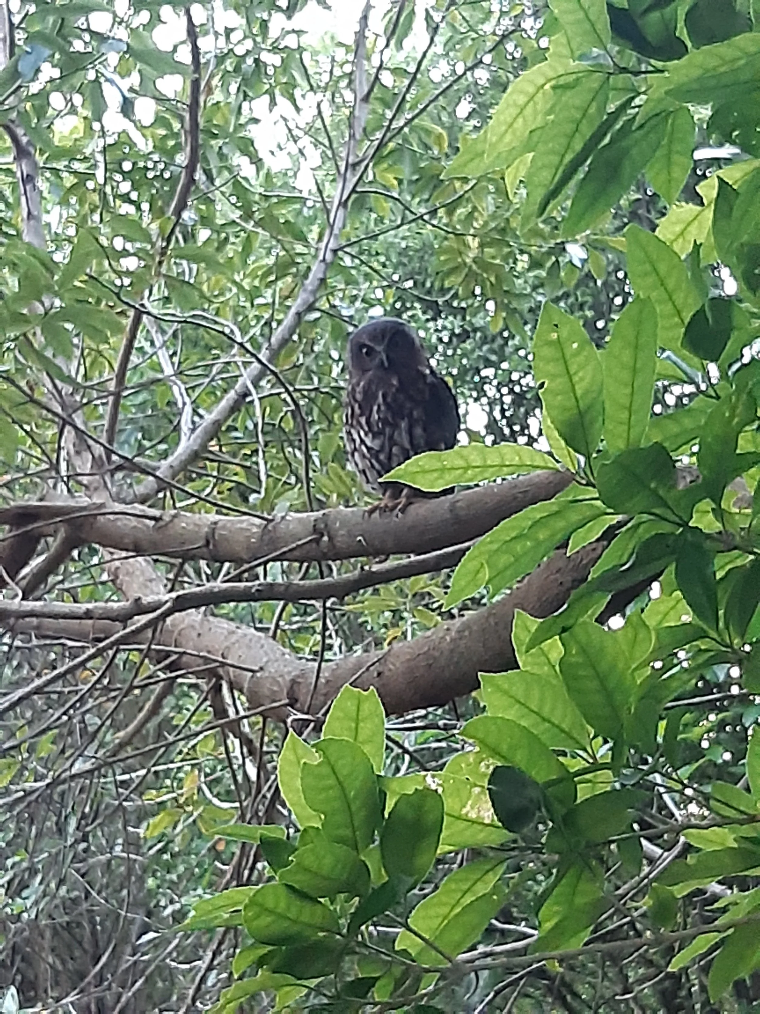
An injured ruru found on Whareroa and cared for by Shane W on Sunday, May 3, 2026. A day later it had recovered enough to fly off for a happy end to this story. Click on the picture for more info.
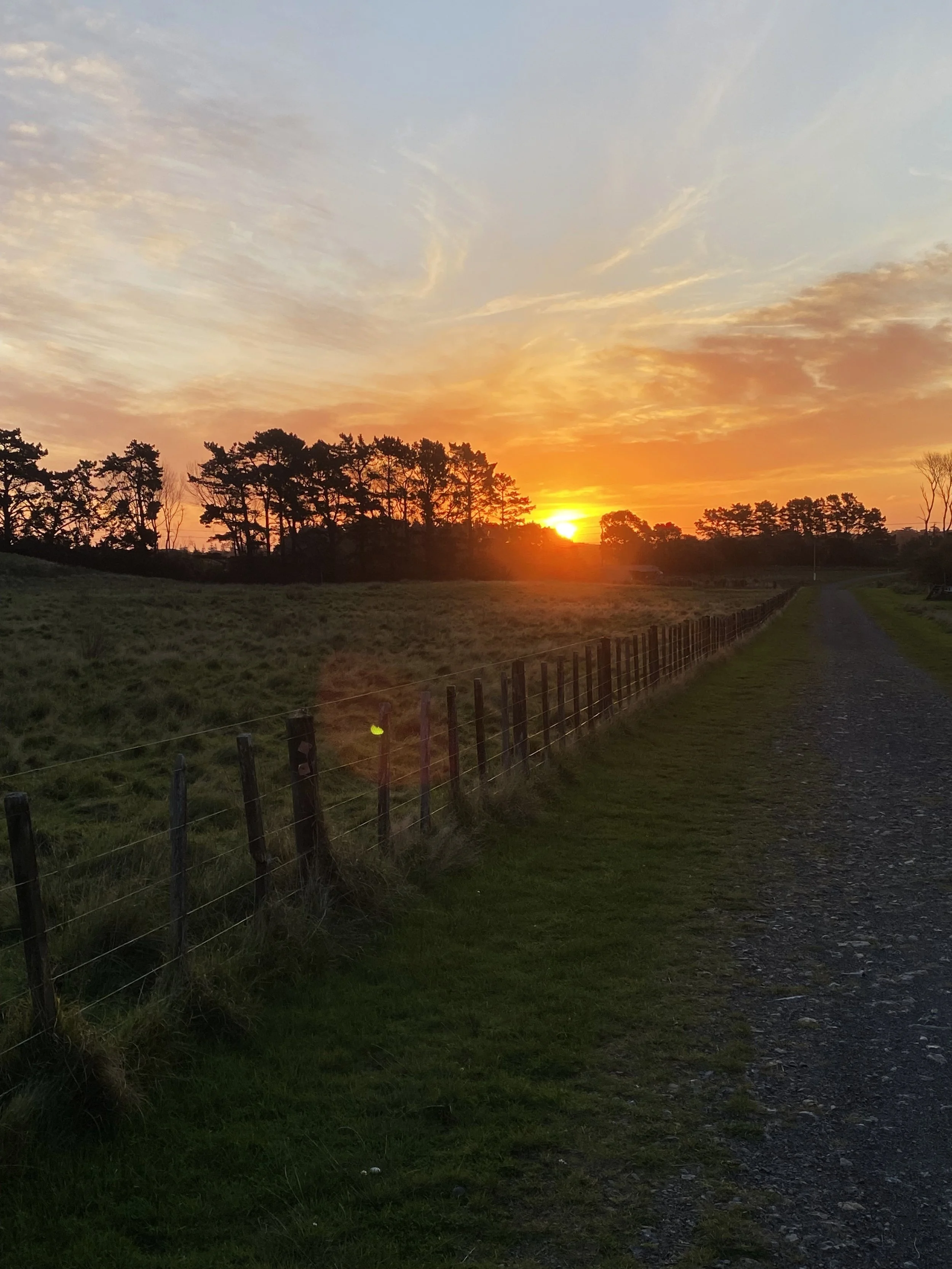
Whareroa Farm, sunset. Photo Rhett, 26.4.26
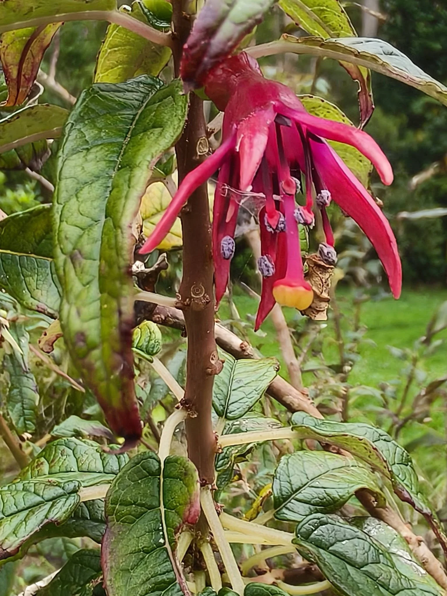
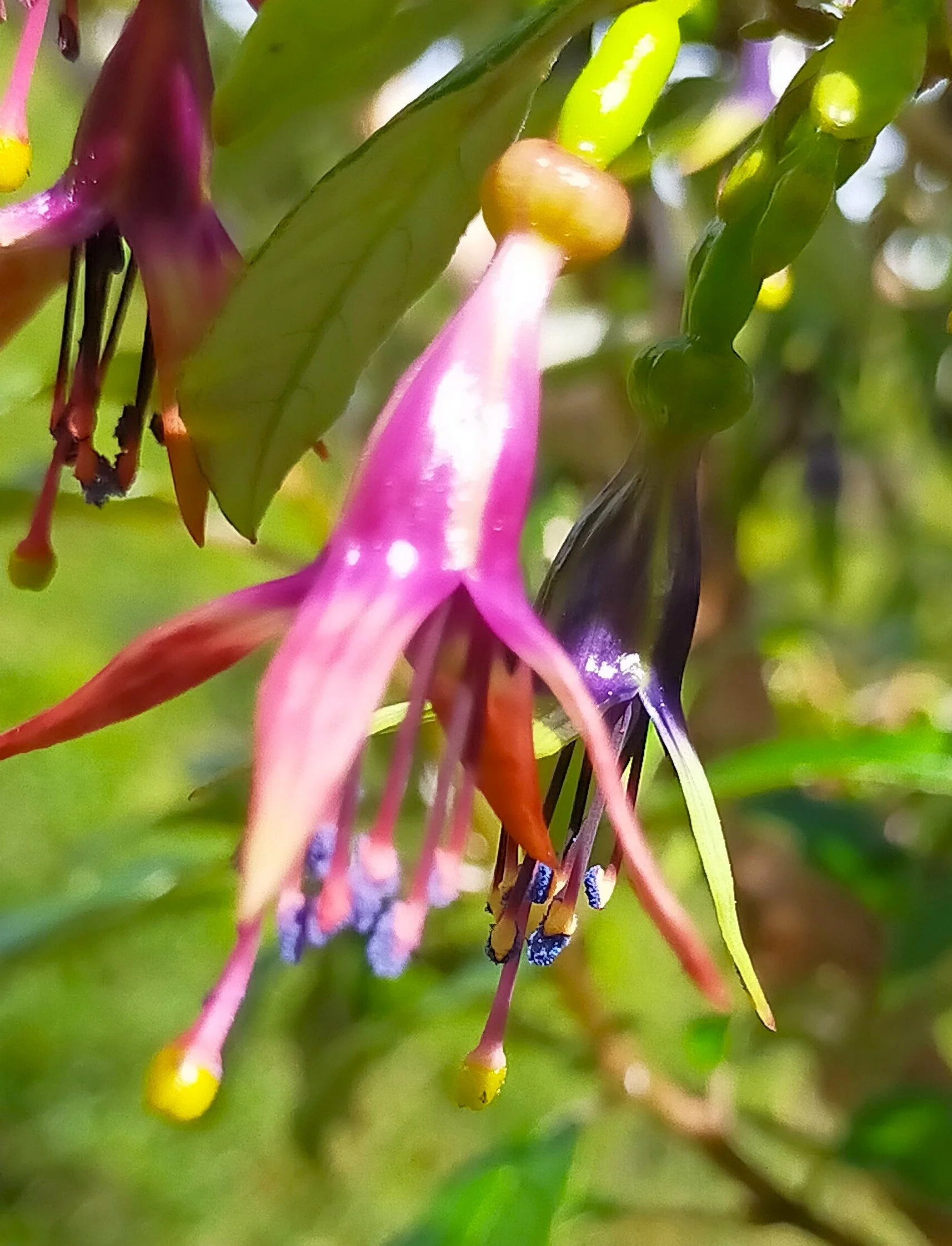
Kotukutuku flowers, usually bloom in August, have blue pollen. These are a bit past their best blue pollen stage. Photo Jan, 8.4.26
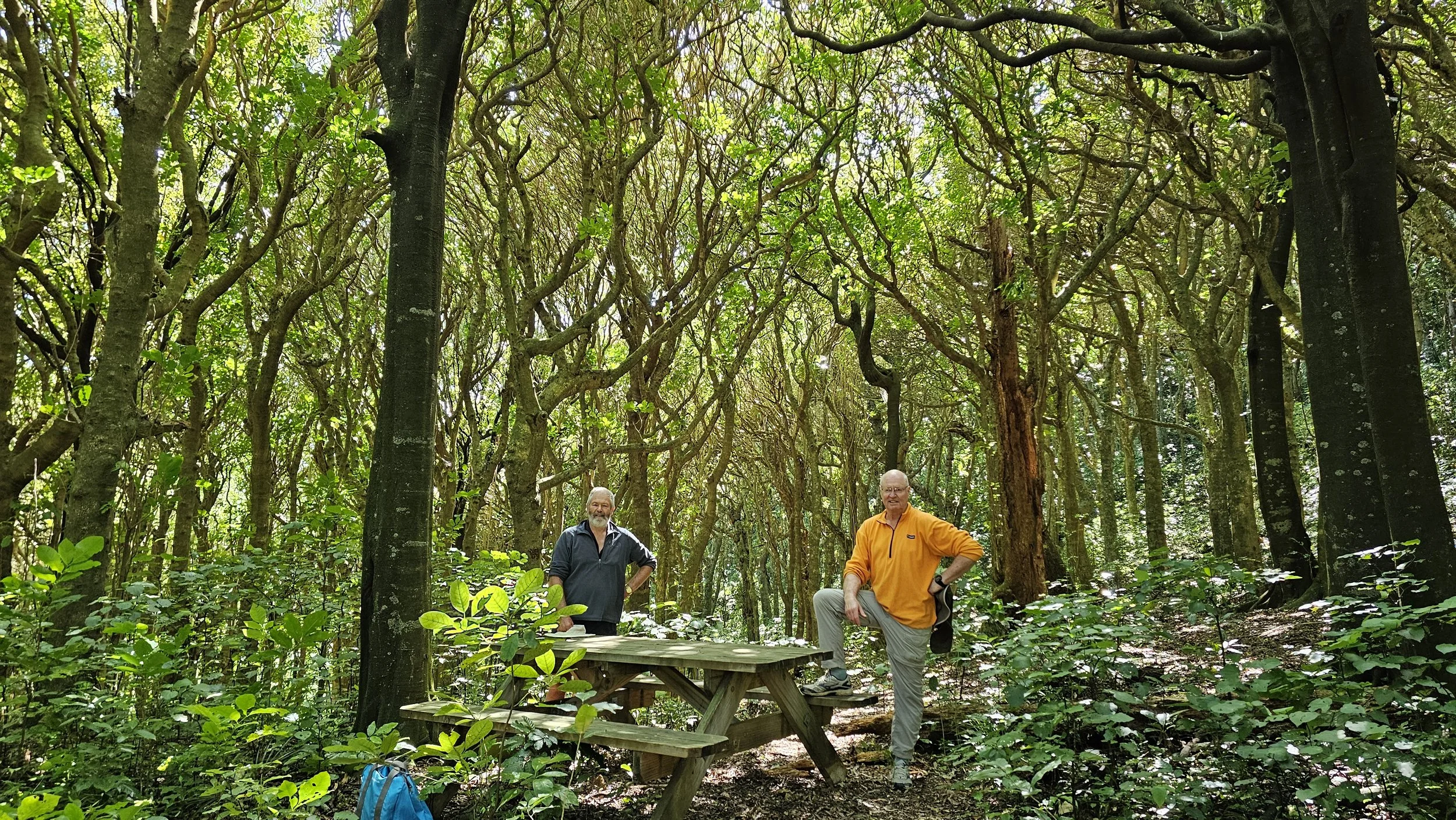
The 2 Shanes at the picnic table in Kohekohe Bush. Click on the picture and google maps will open showing the location of the picnic table
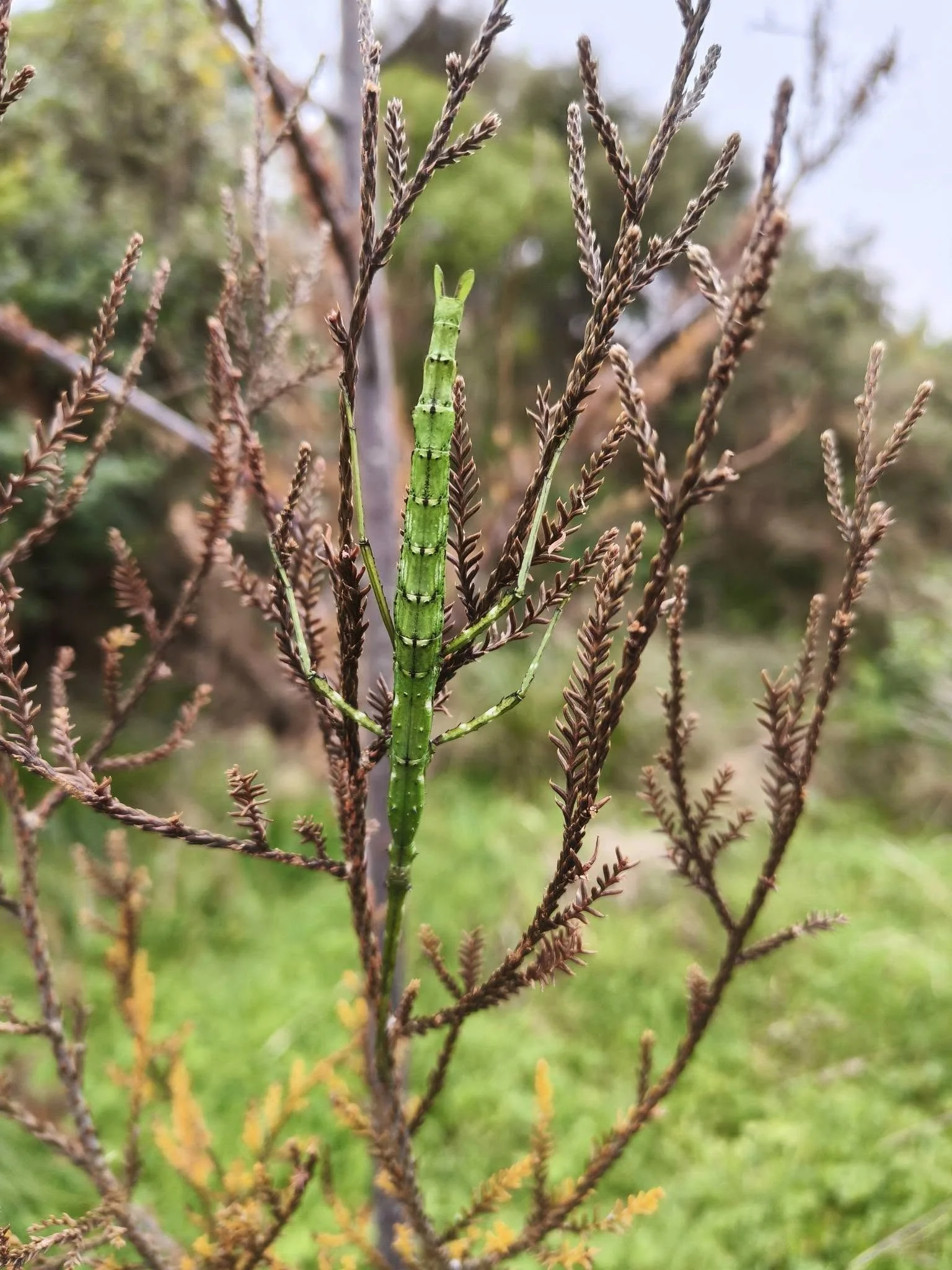
This stick insect hasn't quite sorted the camouflage colour. Photo Jan, 8.4.26
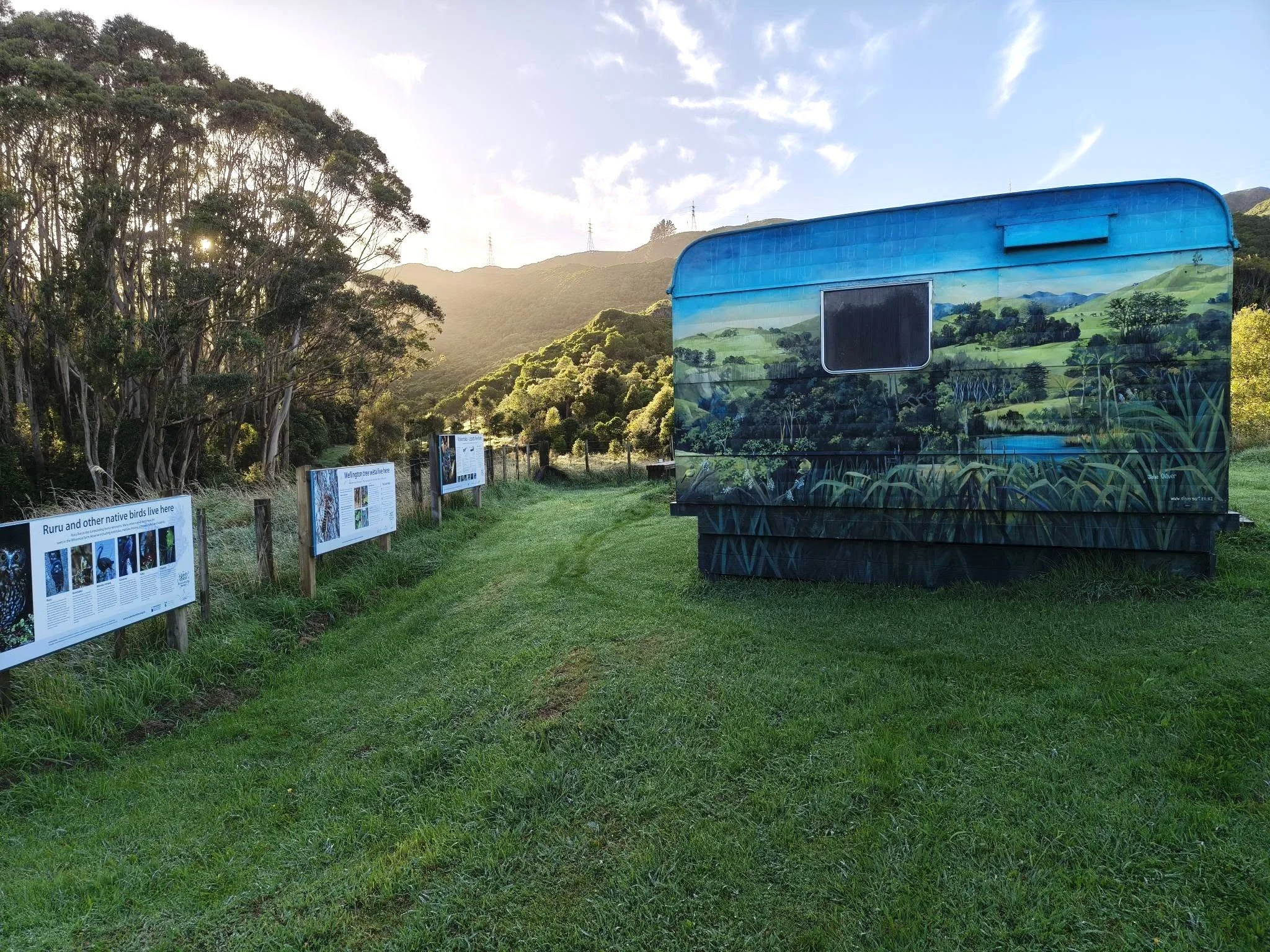
The caravan at the hub looking wonderful in the early morning light. Photo Jan, 31.3.26
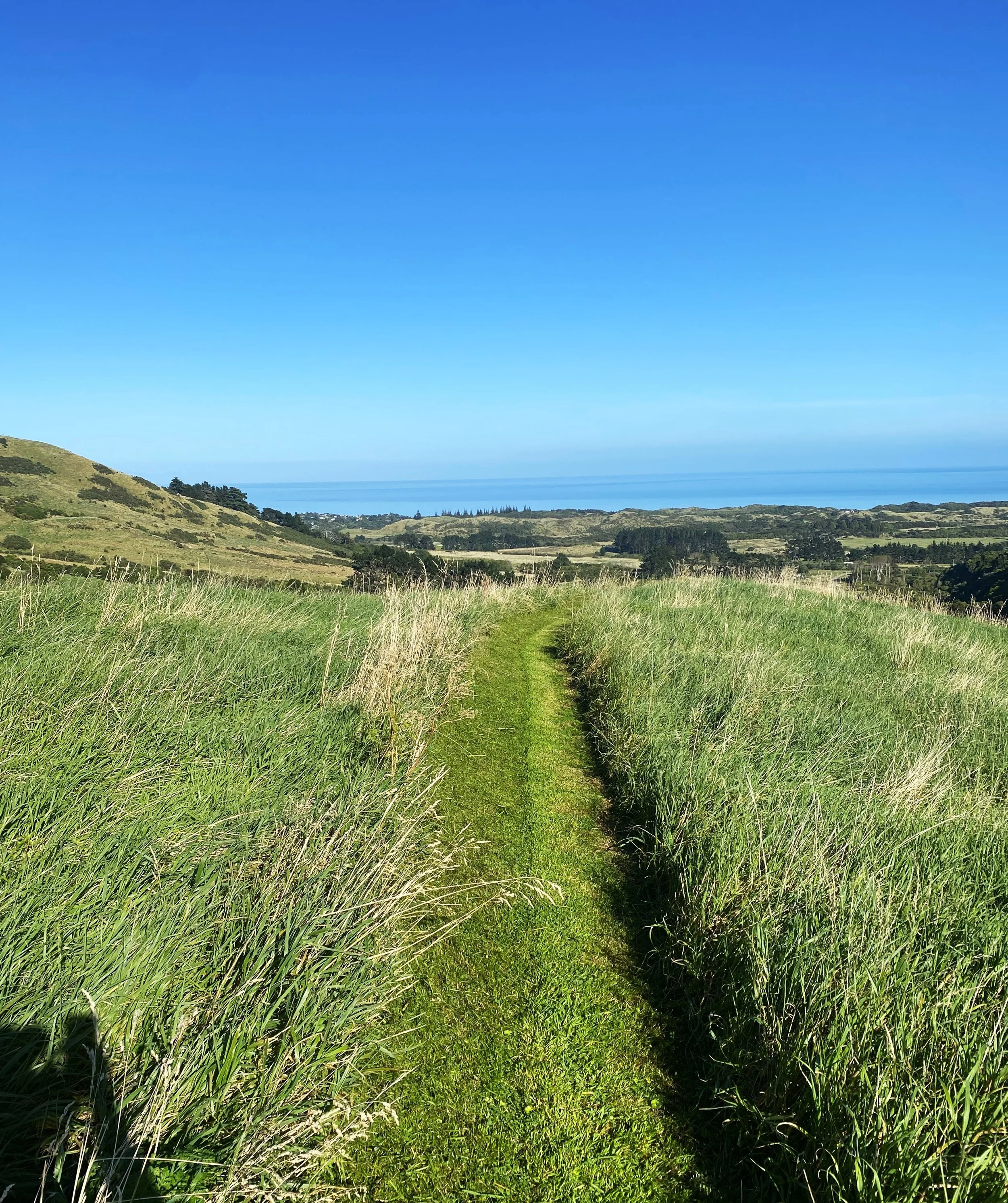
A freshly mown track with a great view. Photo Rhett, 25.2.26
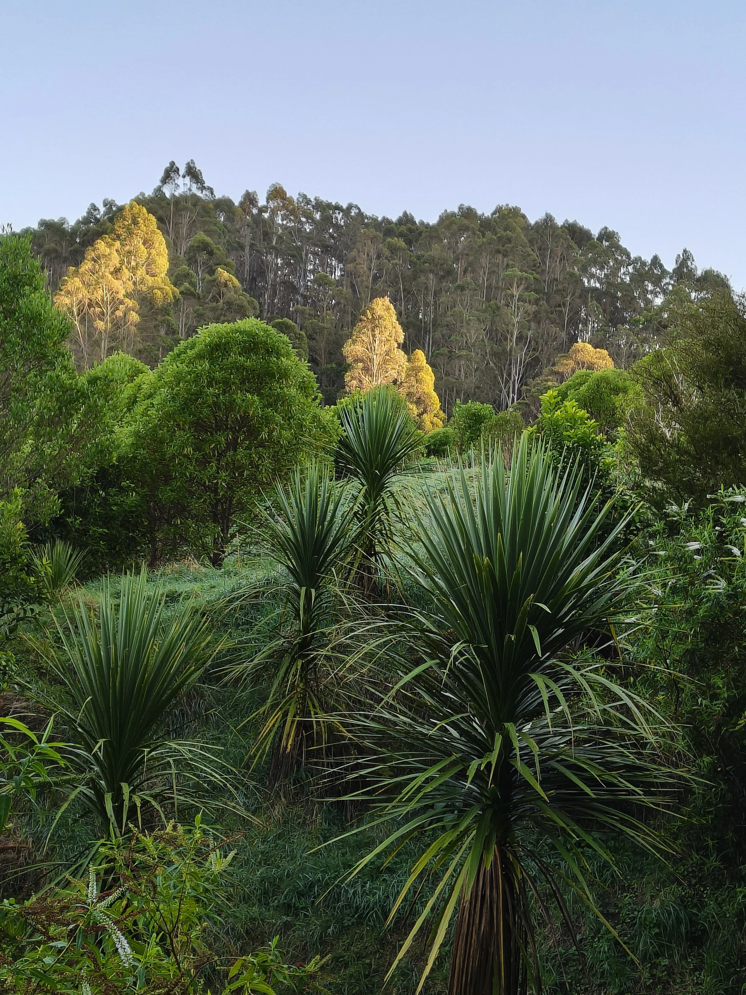
Farm scene from Whareroa Farm. Photo Jan, 15.2.26
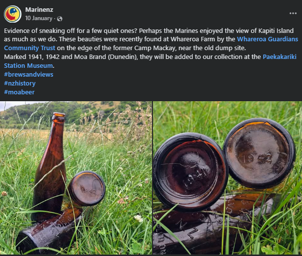
Marinenz on Facebook @KapitiUSMarinesNZ or click on the picture for their website
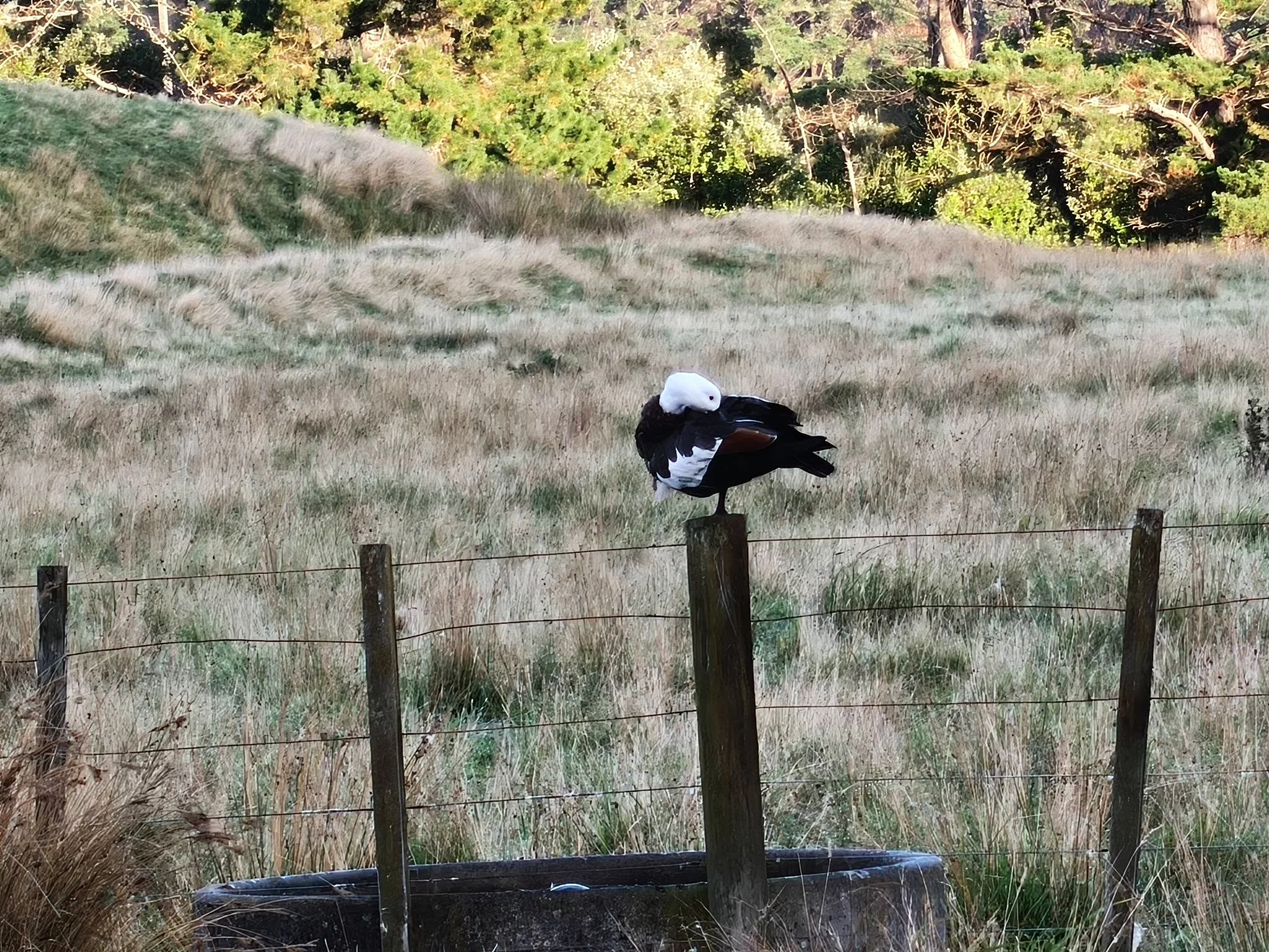
Putangitangi (paradise duck) holding the high ground. Click on the picture to find out more about this bird. Photo Jan, 31.3.26
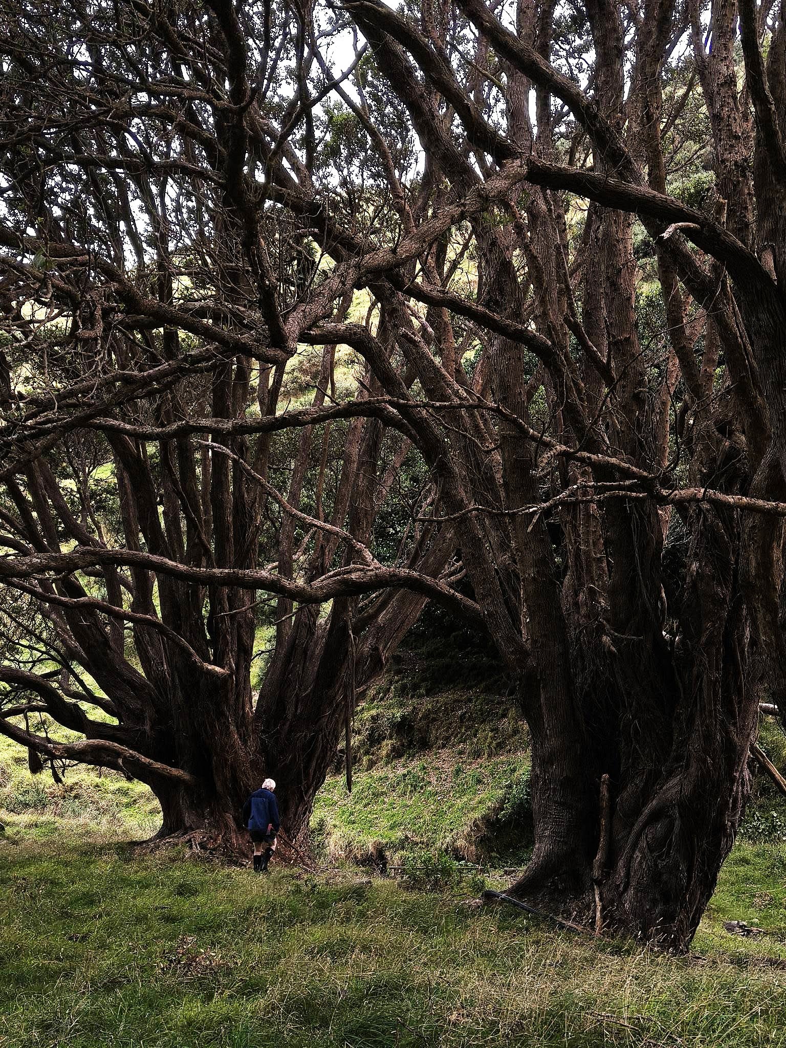
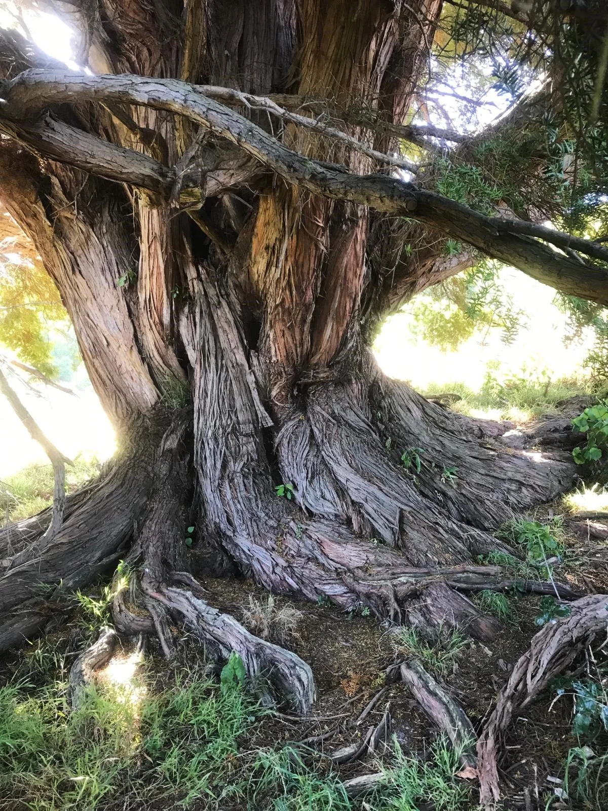
Two massive pohutukawa trees in Ramaroa Valley. Photo Jan, 24.2.26
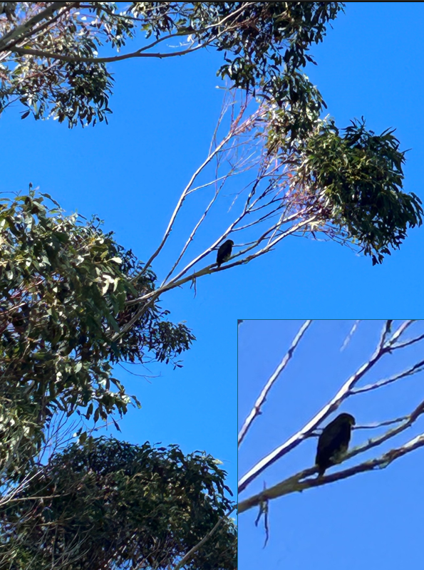
A karearea (the population is classified as "widespread but rare") in the gums just above the Forest Loop turnoff. Click on the picture to see more info. Photo Shane W, 24.4.26
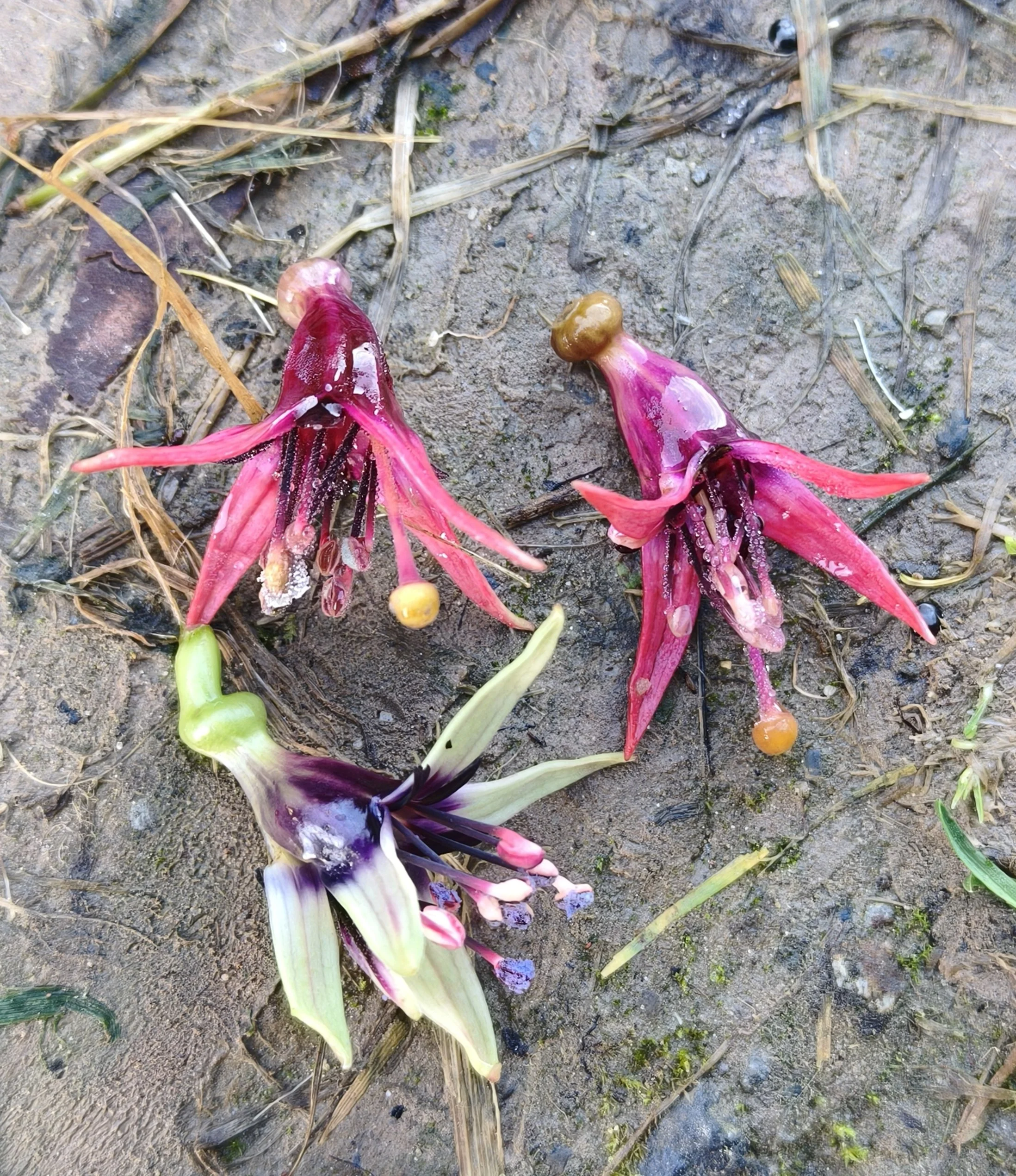
Kotukutuku flowers, they start off (usually in August!) green and white with blue pollen and when pollinated (mainly by Korimako) the flowers turn cerise colour. The berries are sweet, Maori called them Konini. The biggest fuchsia in the world. Photo Jan, 31.3.26
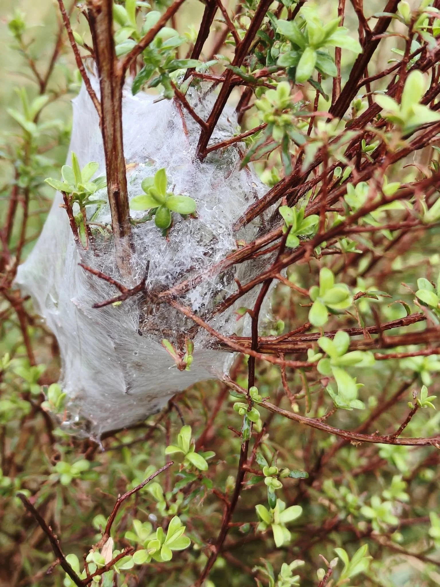
Nursery web spider. Click on the picture for Wikipedia info. Photo Jan, 15.2.26
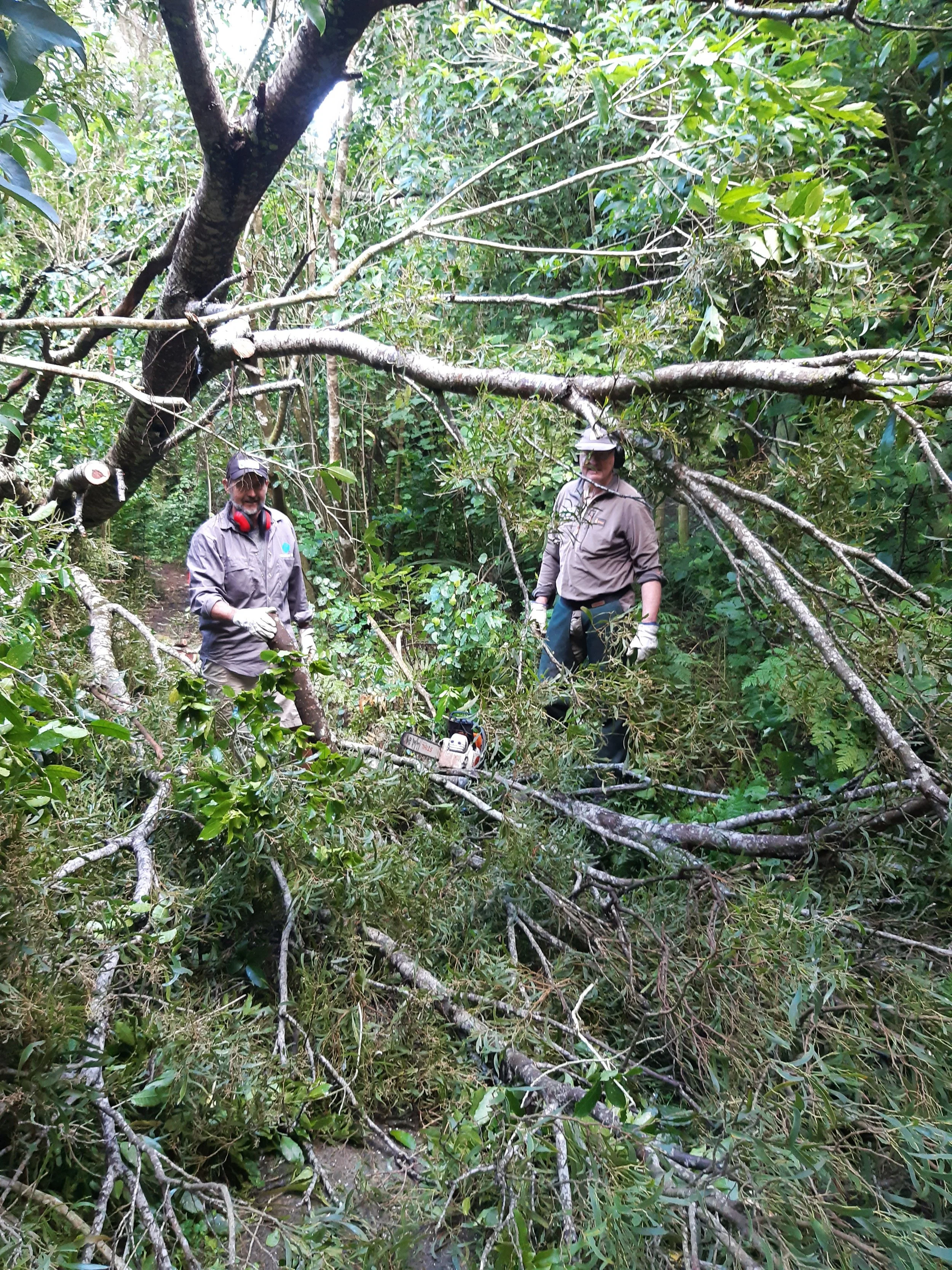
Rhett and Shane W dealing with track obstructions. Photo Ann, 28.4.26
Early morning Whareroa Farm vibes ❤️ Photo Jan, 5.6.26
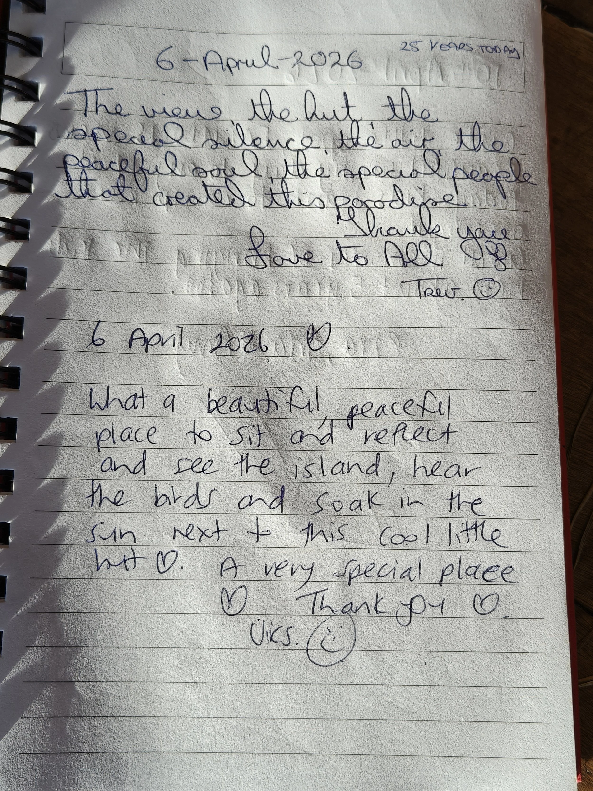
Mini-hut notes left. We think they are great. Click on the note to find the mini-hut (sometimes called the urban hut). Photo Jan, 5.6.26
Picture Gallery, earlier …
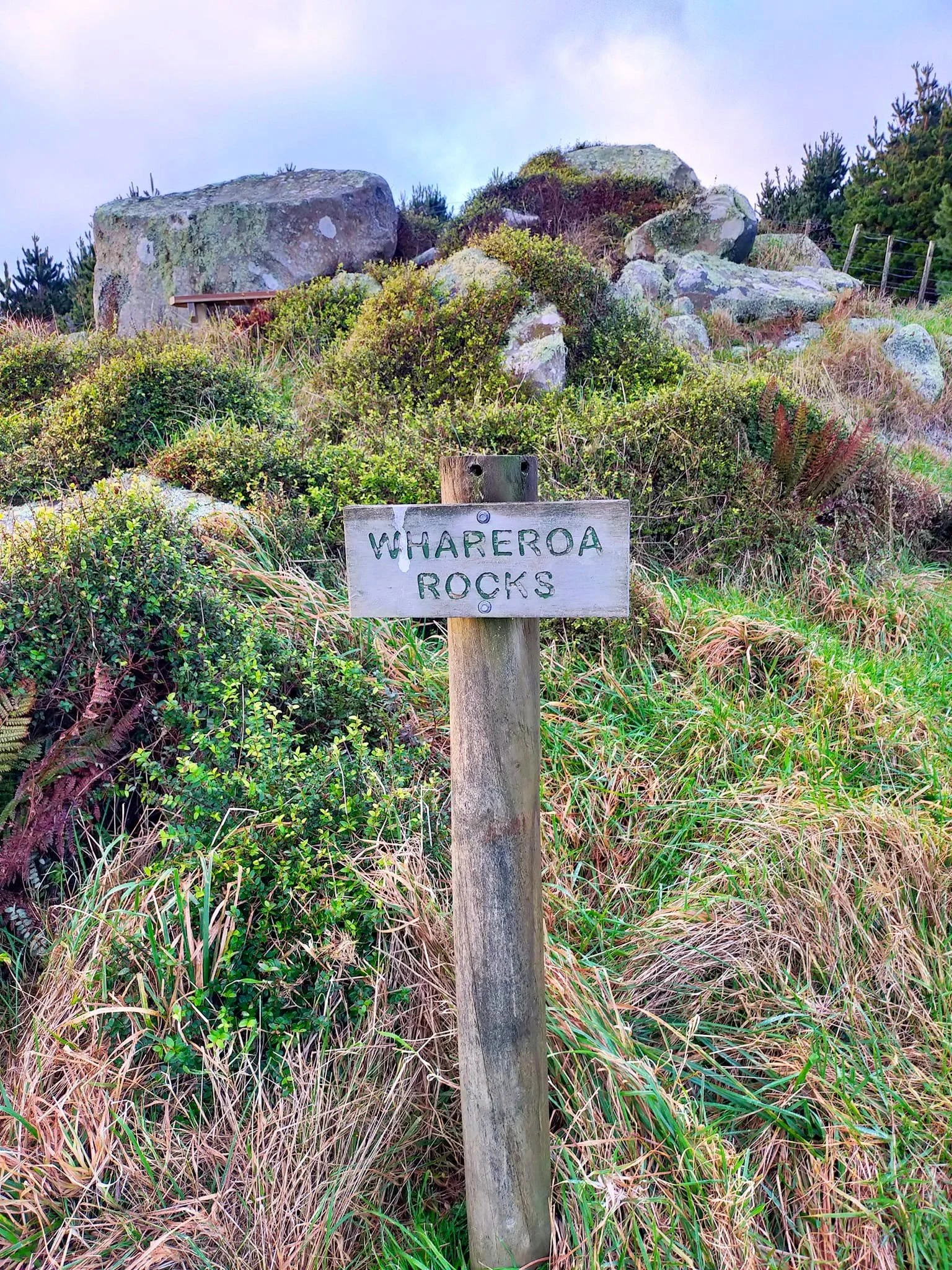
Whareroa Rocks, 2022
A view from higher up, 2022
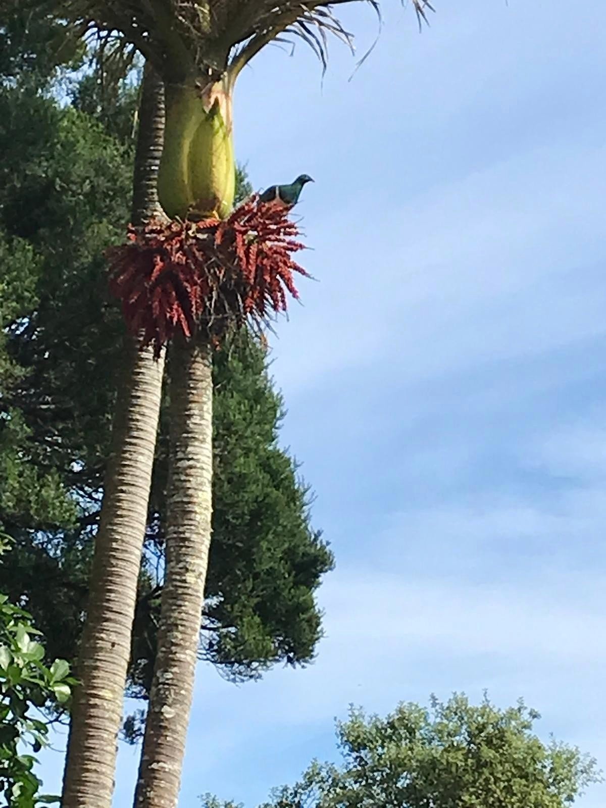
Kereru in Matai Bush. Photo Helen, 25.2.25
Farm scene, Whareroa Farm, 12.8.25
Kotukutuku flowering in Spring. Photo Jan, Oct 2025
The Dell looking sweet. Photo Helen, 16.10.24
Another Whareroa Farm scene. Photo Helen, 1.7.24
A ruru spotted and photographed by Ann, February 2021
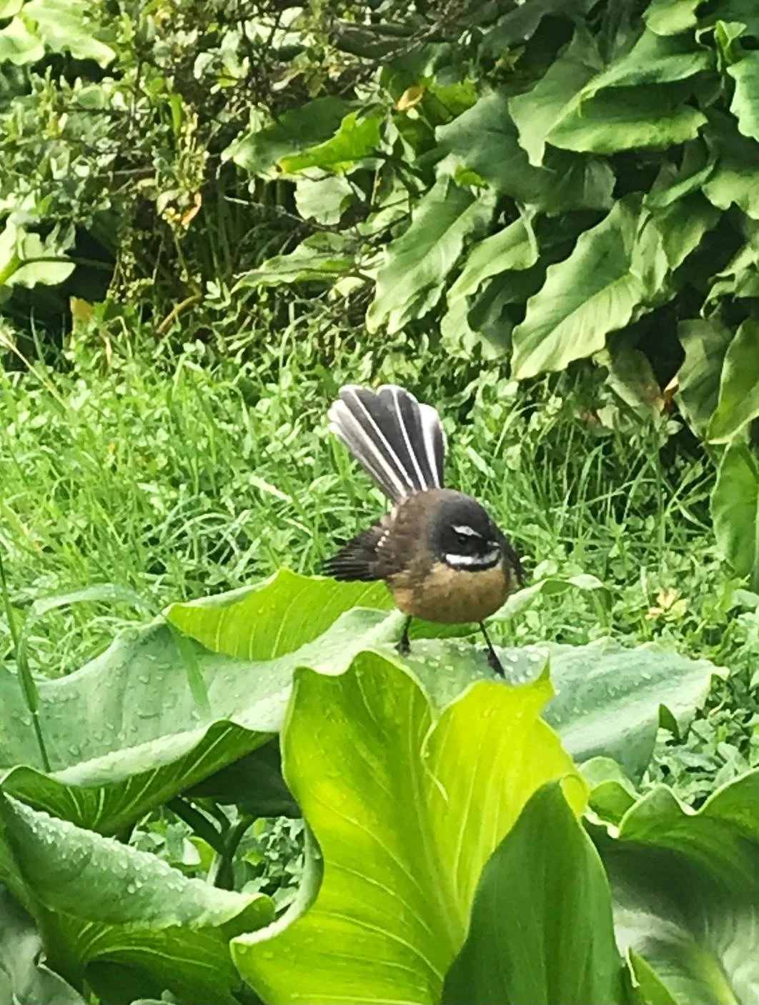
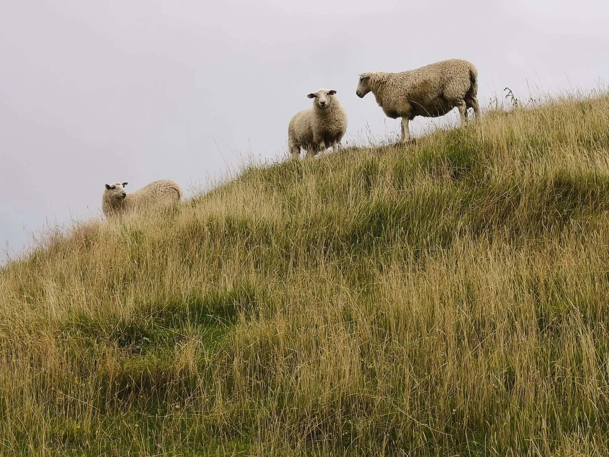
A common companion when walking through Whareroa. Photo Helen, 4.7.24
Majestically looking out over the Dell. Photo Helen, 22.2.24
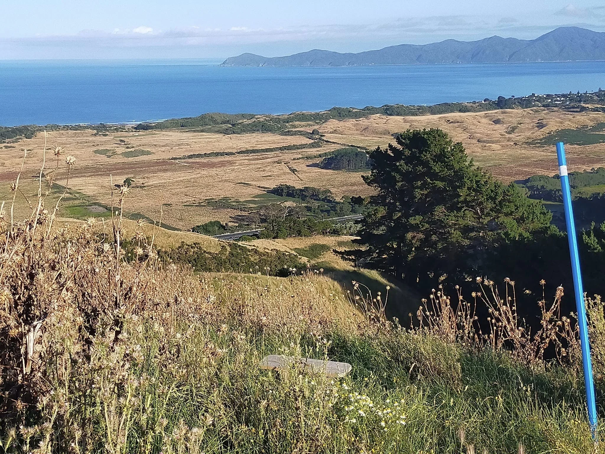
A view across to Kapiti Island, 24.1.23
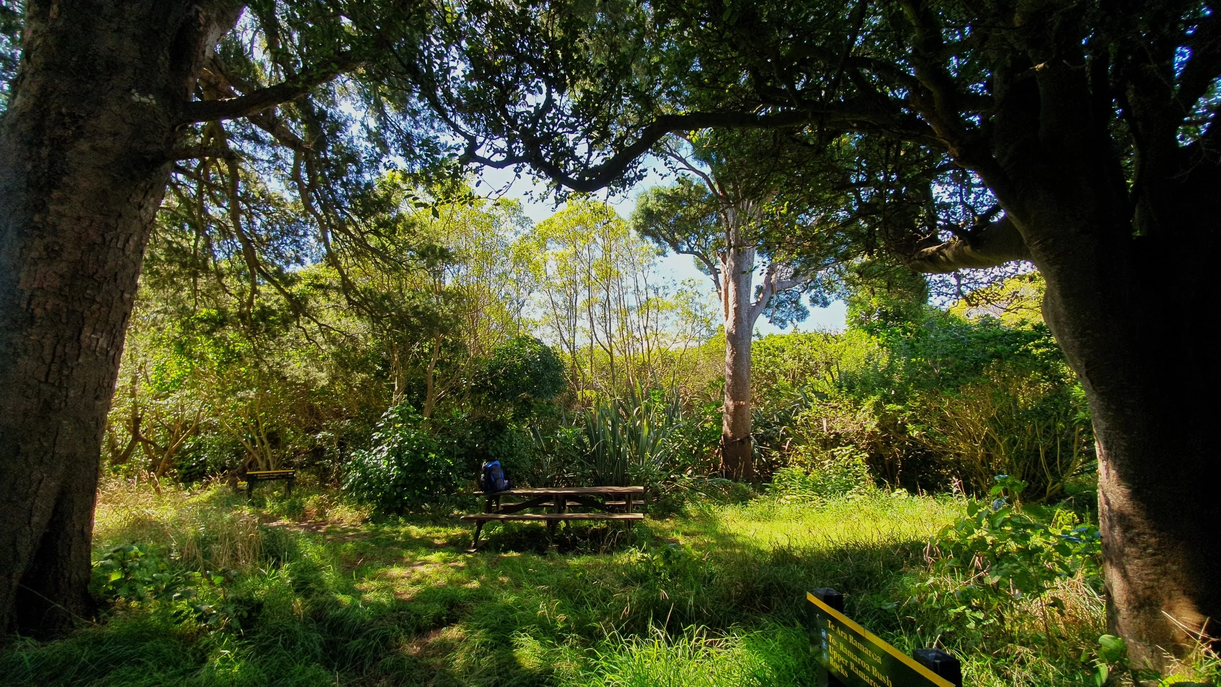
Picnic table in Ramaroa, 6.3.23
Kohekohe Bush, 3.3.23
Flashing way back to 2016, near the gums
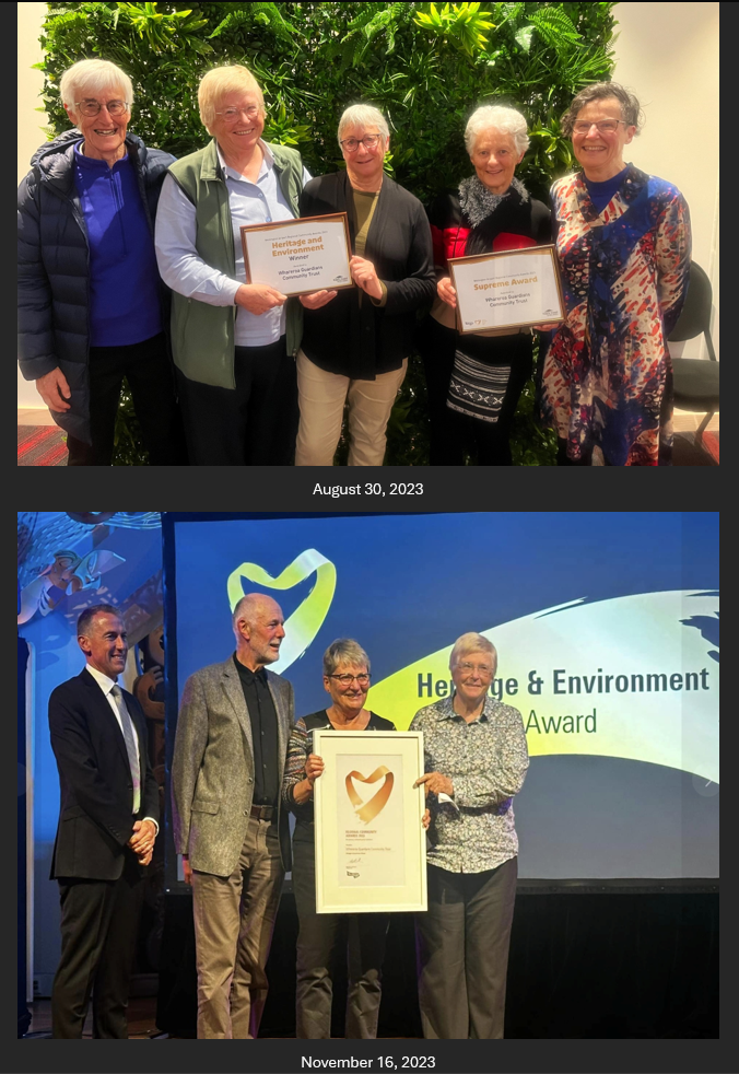
Whareroa Guardians won at the Wellington Airport Community Awards, the regional award in the category Heritage and Environment, 16.11.23. Click on the picture for the full story
Urban hut. Click on the picture for more information, including the origin story. 23.6.22